
UCH KN.UCH - Earthquake Result Viewer
| ||||||||||||||||||
| ||||||||||||||||||
| ||||||||||||||||||
|
Signal To Noise
| Channel | StoN | STA | LTA |
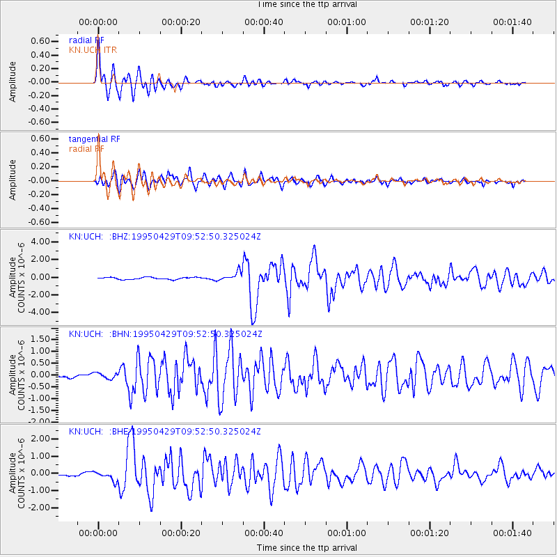
| KN:UCH: :BHN:19950429T09:52:50.325024Z | 1.4942973 | 1.2036995E-7 | 8.055288E-8 |
| KN:UCH: :BHE:19950429T09:52:50.325024Z | 2.7104557 | 2.854985E-7 | 1.0533229E-7 |
| KN:UCH: :BHZ:19950429T09:52:50.325024Z | 4.4830494 | 5.2556965E-7 | 1.17234855E-7 |
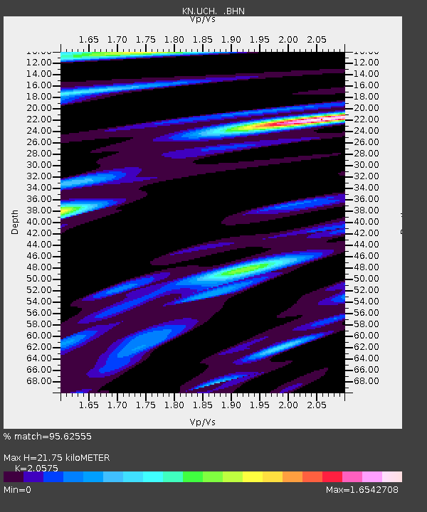
| Arrivals | |
| Ps | 3.8 SECOND |
| PpPs | 10 SECOND |
| PsPs/PpSs | 14 SECOND |

