UCH KN.UCH - Earthquake Result Viewer
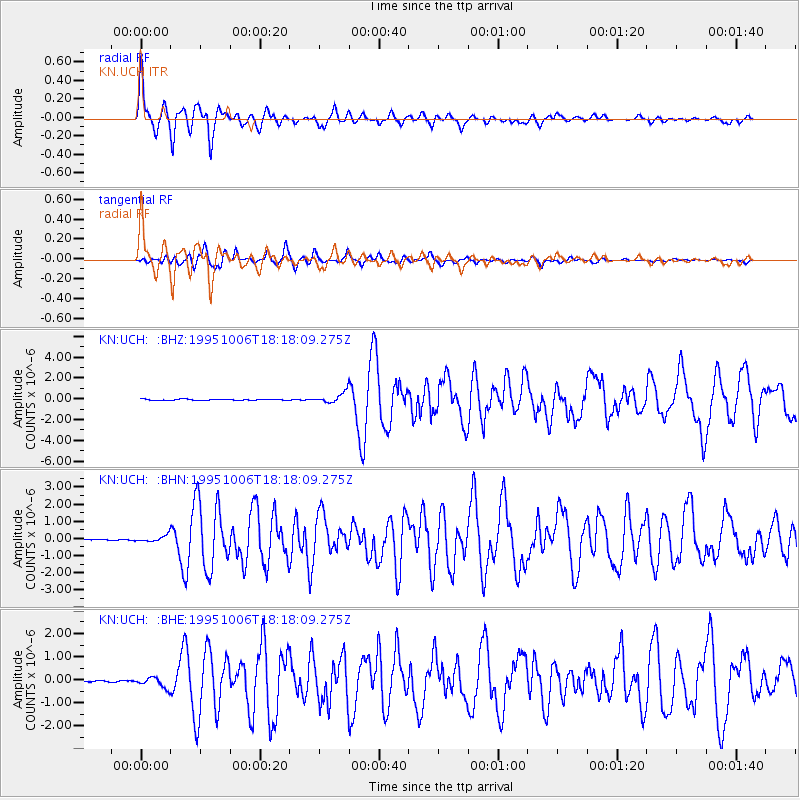
Earthquake location: Southern Sumatra, Indonesia
Earthquake latitude/longitude: -2.1/101.4
Earthquake time(UTC): 1995/10/06 (279) 18:09:45 GMT
Earthquake Depth: 33 km
Earthquake Magnitude: 5.8 MB, 6.9 MS, 6.8 UNKNOWN, 6.8 MW
Earthquake Catalog/Contributor: WHDF/NEIC
Network: KN Kyrgyz Seismic Telemetry Network
Station: UCH KN.UCH
Lat/Lon: 42.23 N/74.51 E
Elevation: 3850 m
Distance: 50.4 deg
Az: 334.135 deg
Baz: 144.058 deg
Ray Param: 0.06803059
Estimated Moho Depth: 10.0 km
Estimated Crust Vp/Vs: 1.78
Assumed Crust Vp: 6.306 km/s
Estimated Crust Vs: 3.548 km/s
Estimated Crust Poisson's Ratio: 0.27
Radial Match: 93.59225 %
Radial Bump: 400
Transverse Match: 89.42569 %
Transverse Bump: 400
SOD ConfigId: 6273
Insert Time: 2010-03-08 21:27:51.567 +0000
GWidth: 2.5
Max Bumps: 400
Tol: 0.001

Signal To Noise

ChannelStoNSTALTA
KN:UCH: :BHN:19951006T18:18:09.275Z3.6232412.0317219E-75.6074715E-8
KN:UCH: :BHE:19951006T18:18:09.275Z4.48654132.2962743E-75.1181395E-8
KN:UCH: :BHZ:19951006T18:18:09.275Z9.2828785.1009386E-75.494997E-8
Arrivals
Ps1.3 SECOND
PpPs4.2 SECOND
PsPs/PpSs5.5 SECOND