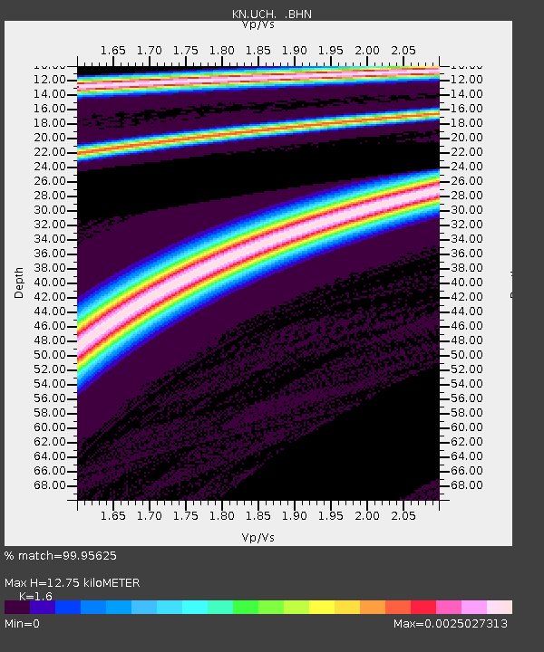
UCH KN.UCH - Earthquake Result Viewer
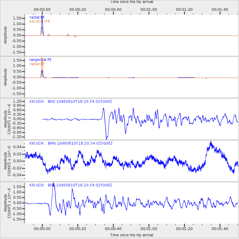
Earthquake location: Eastern Honshu, Japan
Earthquake latitude/longitude: 38.9/140.5
Earthquake time(UTC): 1996/08/10 (223) 18:12:17 GMT
Earthquake Depth: 10 km
Earthquake Magnitude: 6.0 MB, 5.7 MS, 5.9 UNKNOWN, 5.9 MW
Earthquake Catalog/Contributor: WHDF/NEIC
Network: KN Kyrgyz Seismic Telemetry Network
Station: UCH KN.UCH
Lat/Lon: 42.23 N/74.51 E
Elevation: 3850 m
Distance: 49.1 deg
Az: 296.177 deg
Baz: 70.513 deg
Ray Param: 0.06890182
Estimated Moho Depth: 12.75 km
Estimated Crust Vp/Vs: 1.60
Assumed Crust Vp: 6.306 km/s
Estimated Crust Vs: 3.941 km/s
Estimated Crust Poisson's Ratio: 0.18
Radial Match: 99.95625 %
Radial Bump: 4
Transverse Match: 98.65805 %
Transverse Bump: 162
SOD ConfigId: 6273
Insert Time: 2010-03-08 21:28:04.451 +0000
GWidth: 2.5
Max Bumps: 400
Tol: 0.001

Signal To Noise

ChannelStoNSTALTA
KN:UCH: :BHN:19960810T18:20:34.025006Z0.995422661.706475E-81.714322E-8
KN:UCH: :BHE:19960810T18:20:34.025006Z8.7586433.5981463E-74.1081094E-8
KN:UCH: :BHZ:19960810T18:20:34.025006Z9.0240642.6042645E-72.8859109E-8
Arrivals
Ps1.3 SECOND
PpPs4.9 SECOND
PsPs/PpSs6.2 SECOND