UCH KN.UCH - Earthquake Result Viewer
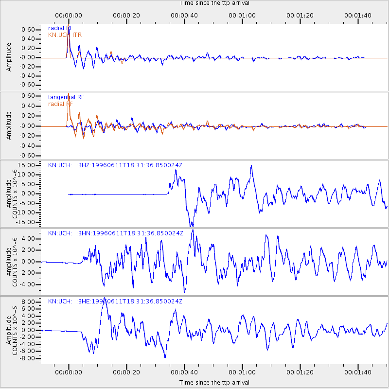
Earthquake location: Samar, Philippines
Earthquake latitude/longitude: 12.6/125.2
Earthquake time(UTC): 1996/06/11 (163) 18:22:55 GMT
Earthquake Depth: 33 km
Earthquake Magnitude: 6.0 MB, 7.0 MS, 7.2 UNKNOWN, 7.1 MW
Earthquake Catalog/Contributor: WHDF/NEIC
Network: KN Kyrgyz Seismic Telemetry Network
Station: UCH KN.UCH
Lat/Lon: 42.23 N/74.51 E
Elevation: 3850 m
Distance: 52.8 deg
Az: 313.838 deg
Baz: 108.556 deg
Ray Param: 0.066488504
Estimated Moho Depth: 10.0 km
Estimated Crust Vp/Vs: 1.72
Assumed Crust Vp: 6.306 km/s
Estimated Crust Vs: 3.661 km/s
Estimated Crust Poisson's Ratio: 0.25
Radial Match: 97.596 %
Radial Bump: 400
Transverse Match: 92.20122 %
Transverse Bump: 400
SOD ConfigId: 6273
Insert Time: 2010-03-08 21:28:20.301 +0000
GWidth: 2.5
Max Bumps: 400
Tol: 0.001

Signal To Noise

ChannelStoNSTALTA
KN:UCH: :BHN:19960611T18:31:36.850024Z4.1258451.7581692E-74.2613554E-8
KN:UCH: :BHE:19960611T18:31:36.850024Z8.78817754.26154E-74.849174E-8
KN:UCH: :BHZ:19960611T18:31:36.850024Z15.4732057.49364E-74.842979E-8
Arrivals
Ps1.2 SECOND
PpPs4.1 SECOND
PsPs/PpSs5.3 SECOND