UCH KN.UCH - Earthquake Result Viewer
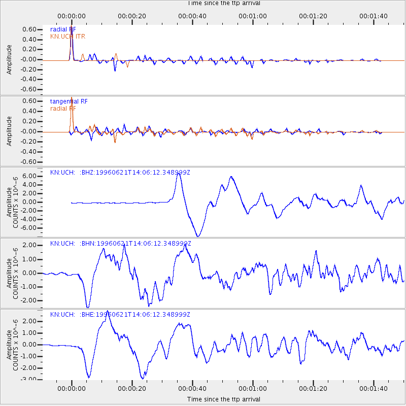
Earthquake location: Off East Coast Of Kamchatka
Earthquake latitude/longitude: 51.6/159.1
Earthquake time(UTC): 1996/06/21 (173) 13:57:10 GMT
Earthquake Depth: 20 km
Earthquake Magnitude: 6.0 MB, 6.6 MS, 7.0 UNKNOWN, 6.5 MS
Earthquake Catalog/Contributor: WHDF/NEIC
Network: KN Kyrgyz Seismic Telemetry Network
Station: UCH KN.UCH
Lat/Lon: 42.23 N/74.51 E
Elevation: 3850 m
Distance: 55.5 deg
Az: 296.17 deg
Baz: 48.956 deg
Ray Param: 0.064744204
Estimated Moho Depth: 62.5 km
Estimated Crust Vp/Vs: 1.60
Assumed Crust Vp: 6.306 km/s
Estimated Crust Vs: 3.941 km/s
Estimated Crust Poisson's Ratio: 0.18
Radial Match: 96.25506 %
Radial Bump: 284
Transverse Match: 90.94034 %
Transverse Bump: 400
SOD ConfigId: 6273
Insert Time: 2010-03-08 21:28:25.168 +0000
GWidth: 2.5
Max Bumps: 400
Tol: 0.001

Signal To Noise

ChannelStoNSTALTA
KN:UCH: :BHN:19960621T14:06:12.348999Z14.365166.650995E-74.6299483E-8
KN:UCH: :BHE:19960621T14:06:12.348999Z18.9895526.2659467E-73.299681E-8
KN:UCH: :BHZ:19960621T14:06:12.348999Z45.756861.7696902E-63.8675957E-8
Arrivals
Ps6.3 SECOND
PpPs24 SECOND
PsPs/PpSs31 SECOND