You are here: Home > Network List > CU - Caribbean Network (USGS) Stations List
> Station BBGH Gun Hill, Barbados > Earthquake Result Viewer
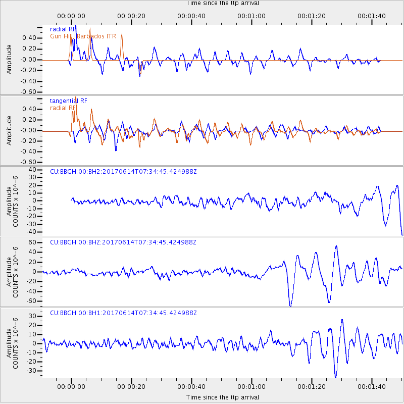
BBGH Gun Hill, Barbados - Earthquake Result Viewer
*The percent match for this event was below the threshold and hence no stack was calculated.
| Earthquake location: |
Near Coast Of Chiapas, Mexico |
| Earthquake latitude/longitude: |
14.9/-92.0 |
| Earthquake time(UTC): |
2017/06/14 (165) 07:29:03 GMT |
| Earthquake Depth: |
98 km |
| Earthquake Magnitude: |
7.0 Mi |
| Earthquake Catalog/Contributor: |
NEIC PDE/at |
|
| Network: |
CU Caribbean Network (USGS) |
| Station: |
BBGH Gun Hill, Barbados |
| Lat/Lon: |
13.14 N/59.56 W |
| Elevation: |
180 m |
|
| Distance: |
31.5 deg |
| Az: |
89.082 deg |
| Baz: |
277.096 deg |
| Ray Param: |
$rayparam |
*The percent match for this event was below the threshold and hence was not used in the summary stack. |
|
| Radial Match: |
88.14749 % |
| Radial Bump: |
400 |
| Transverse Match: |
81.009834 % |
| Transverse Bump: |
400 |
| SOD ConfigId: |
2140511 |
| Insert Time: |
2017-06-27 23:21:20.168 +0000 |
| GWidth: |
2.5 |
| Max Bumps: |
400 |
| Tol: |
0.001 |
|
Signal To Noise
| Channel | StoN | STA | LTA |
| CU:BBGH:00:BHZ:20170614T07:34:45.424988Z | 2.7074685 | 4.5476463E-6 | 1.6796674E-6 |
| CU:BBGH:00:BH1:20170614T07:34:45.424988Z | 0.77822876 | 1.9543934E-6 | 2.5113354E-6 |
| CU:BBGH:00:BH2:20170614T07:34:45.424988Z | 2.6568747 | 5.0137132E-6 | 1.8870718E-6 |
| Arrivals |
| Ps | |
| PpPs | |
| PsPs/PpSs | |


