
UCH KN.UCH - Earthquake Result Viewer
| ||||||||||||||||||
| ||||||||||||||||||
| ||||||||||||||||||
|
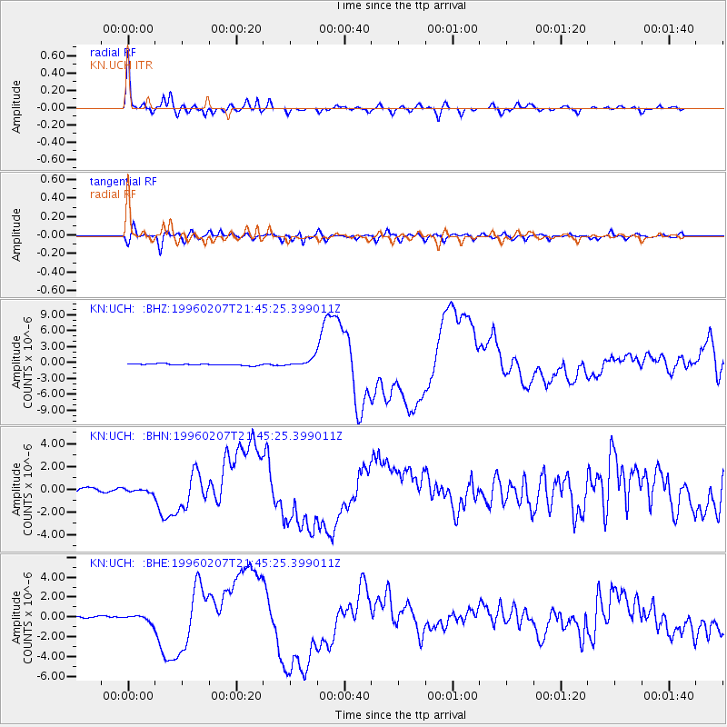
Signal To Noise
| Channel | StoN | STA | LTA |
| KN:UCH: :BHN:19960207T21:45:25.399011Z | 1.5100243 | 1.8415084E-7 | 1.2195224E-7 |
| KN:UCH: :BHE:19960207T21:45:25.399011Z | 2.4055398 | 3.5483615E-7 | 1.4750792E-7 |
| KN:UCH: :BHZ:19960207T21:45:25.399011Z | 5.235987 | 7.871149E-7 | 1.5032789E-7 |
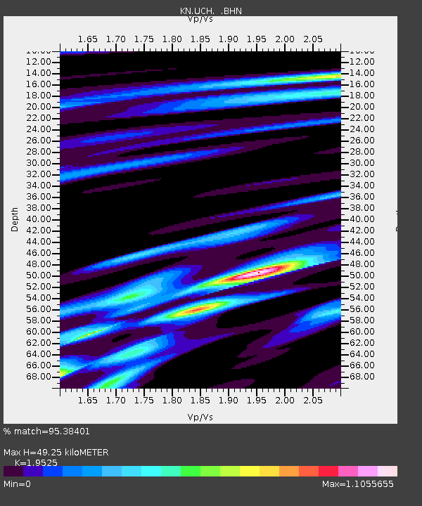
| Arrivals | |
| Ps | 7.8 SECOND |
| PpPs | 22 SECOND |
| PsPs/PpSs | 30 SECOND |

