UCH KN.UCH - Earthquake Result Viewer
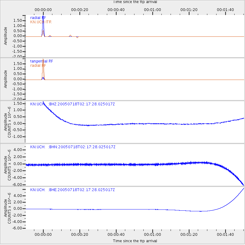
Earthquake location: Timor Region
Earthquake latitude/longitude: -9.9/124.2
Earthquake time(UTC): 2005/07/18 (199) 02:06:53 GMT
Earthquake Depth: 10 km
Earthquake Magnitude: 5.7 MB, 5.2 MS, 5.5 MW, 5.5 MW
Earthquake Catalog/Contributor: WHDF/NEIC
Network: KN Kyrgyz Seismic Telemetry Network
Station: UCH KN.UCH
Lat/Lon: 42.23 N/74.51 E
Elevation: 3850 m
Distance: 69.0 deg
Az: 322.625 deg
Baz: 126.365 deg
Ray Param: 0.055944253
Estimated Moho Depth: 10.0 km
Estimated Crust Vp/Vs: 1.60
Assumed Crust Vp: 6.306 km/s
Estimated Crust Vs: 3.941 km/s
Estimated Crust Poisson's Ratio: 0.18
Radial Match: 99.99998 %
Radial Bump: 2
Transverse Match: 99.99811 %
Transverse Bump: 2
SOD ConfigId: 2669
Insert Time: 2010-03-08 21:29:13.336 +0000
GWidth: 2.5
Max Bumps: 400
Tol: 0.001

Signal To Noise

ChannelStoNSTALTA
KN:UCH: :BHN:20050718T02:17:28.025017Z0.907223944.6470365E-75.12226E-7
KN:UCH: :BHE:20050718T02:17:28.025017Z0.90725134.88707E-75.386677E-7
KN:UCH: :BHZ:20050718T02:17:28.025017Z0.90244384.5289184E-75.018505E-7
Arrivals
Ps1.0 SECOND
PpPs4.0 SECOND
PsPs/PpSs4.9 SECOND