You are here: Home > Network List > TA - USArray Transportable Network (new EarthScope stations) Stations List
> Station E20K Nigu River, AK, USA > Earthquake Result Viewer
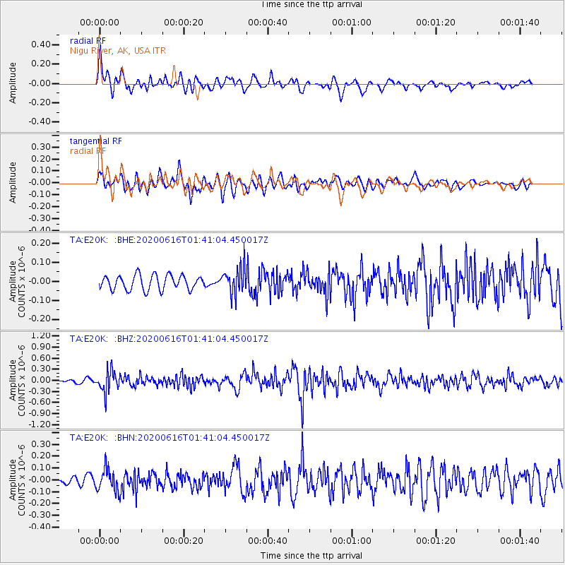
E20K Nigu River, AK, USA - Earthquake Result Viewer
*The percent match for this event was below the threshold and hence no stack was calculated.
| Earthquake location: |
Tajikistan |
| Earthquake latitude/longitude: |
37.8/72.2 |
| Earthquake time(UTC): |
2020/06/16 (168) 01:30:48 GMT |
| Earthquake Depth: |
127 km |
| Earthquake Magnitude: |
5.6 mww |
| Earthquake Catalog/Contributor: |
NEIC PDE/us |
|
| Network: |
TA USArray Transportable Network (new EarthScope stations) |
| Station: |
E20K Nigu River, AK, USA |
| Lat/Lon: |
68.26 N/156.19 W |
| Elevation: |
866 m |
|
| Distance: |
68.2 deg |
| Az: |
17.458 deg |
| Baz: |
320.392 deg |
| Ray Param: |
$rayparam |
*The percent match for this event was below the threshold and hence was not used in the summary stack. |
|
| Radial Match: |
72.60902 % |
| Radial Bump: |
400 |
| Transverse Match: |
67.648735 % |
| Transverse Bump: |
400 |
| SOD ConfigId: |
21709731 |
| Insert Time: |
2020-06-30 01:45:01.030 +0000 |
| GWidth: |
2.5 |
| Max Bumps: |
400 |
| Tol: |
0.001 |
|
Signal To Noise
| Channel | StoN | STA | LTA |
| TA:E20K: :BHZ:20200616T01:41:04.450017Z | 6.2774477 | 2.821168E-7 | 4.494132E-8 |
| TA:E20K: :BHN:20200616T01:41:04.450017Z | 3.185382 | 9.657304E-8 | 3.031757E-8 |
| TA:E20K: :BHE:20200616T01:41:04.450017Z | 1.8007858 | 6.921629E-8 | 3.8436717E-8 |
| Arrivals |
| Ps | |
| PpPs | |
| PsPs/PpSs | |


