UCH KN.UCH - Earthquake Result Viewer
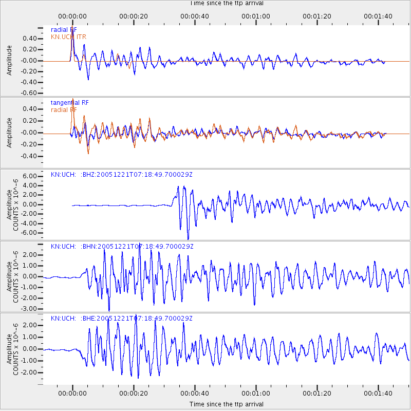
Earthquake location: Southern Molucca Sea
Earthquake latitude/longitude: -0.1/124.7
Earthquake time(UTC): 2005/12/21 (355) 07:09:05 GMT
Earthquake Depth: 25 km
Earthquake Magnitude: 6.3 MB, 5.9 MS, 6.3 MW, 6.2 MW
Earthquake Catalog/Contributor: WHDF/NEIC
Network: KN Kyrgyz Seismic Telemetry Network
Station: UCH KN.UCH
Lat/Lon: 42.23 N/74.51 E
Elevation: 3850 m
Distance: 61.6 deg
Az: 319.603 deg
Baz: 119.241 deg
Ray Param: 0.060713734
Estimated Moho Depth: 10.0 km
Estimated Crust Vp/Vs: 1.72
Assumed Crust Vp: 6.306 km/s
Estimated Crust Vs: 3.677 km/s
Estimated Crust Poisson's Ratio: 0.24
Radial Match: 93.99207 %
Radial Bump: 400
Transverse Match: 86.098 %
Transverse Bump: 400
SOD ConfigId: 2422
Insert Time: 2010-03-08 21:29:24.066 +0000
GWidth: 2.5
Max Bumps: 400
Tol: 0.001

Signal To Noise

ChannelStoNSTALTA
KN:UCH: :BHN:20051221T07:18:49.700029Z4.2439913.037435E-77.157025E-8
KN:UCH: :BHE:20051221T07:18:49.700029Z6.41857245.471047E-78.523776E-8
KN:UCH: :BHZ:20051221T07:18:49.700029Z25.6238461.4000024E-65.46367E-8
Arrivals
Ps1.2 SECOND
PpPs4.1 SECOND
PsPs/PpSs5.3 SECOND