UCH KN.UCH - Earthquake Result Viewer
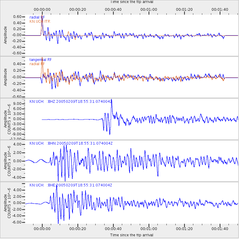
Earthquake location: Bonin Islands, Japan Region
Earthquake latitude/longitude: 26.1/144.0
Earthquake time(UTC): 2005/02/09 (040) 18:46:09 GMT
Earthquake Depth: 24 km
Earthquake Magnitude: 6.2 MB, 6.3 MS, 6.3 MW, 6.3 MW
Earthquake Catalog/Contributor: WHDF/NEIC
Network: KN Kyrgyz Seismic Telemetry Network
Station: UCH KN.UCH
Lat/Lon: 42.23 N/74.51 E
Elevation: 3850 m
Distance: 58.2 deg
Az: 305.068 deg
Baz: 82.305 deg
Ray Param: 0.06296571
Estimated Moho Depth: 22.5 km
Estimated Crust Vp/Vs: 1.92
Assumed Crust Vp: 6.306 km/s
Estimated Crust Vs: 3.284 km/s
Estimated Crust Poisson's Ratio: 0.31
Radial Match: 94.27413 %
Radial Bump: 400
Transverse Match: 90.34397 %
Transverse Bump: 400
SOD ConfigId: 5233
Insert Time: 2010-03-08 21:29:54.048 +0000
GWidth: 2.5
Max Bumps: 400
Tol: 0.001

Signal To Noise

ChannelStoNSTALTA
KN:UCH: :BHN:20050209T18:55:31.074004Z1.57159153.7301504E-72.373486E-7
KN:UCH: :BHE:20050209T18:55:31.074004Z5.83956966.525107E-71.1173952E-7
KN:UCH: :BHZ:20050209T18:55:31.074004Z20.858731.5770614E-67.5606785E-8
Arrivals
Ps3.4 SECOND
PpPs10.0 SECOND
PsPs/PpSs13 SECOND