You are here: Home > Network List > KN - Kyrgyz Seismic Telemetry Network Stations List
> Station UCH KN.UCH > Earthquake Result Viewer
UCH KN.UCH - Earthquake Result Viewer
| Earthquake location: |
Philippine Islands Region |
| Earthquake latitude/longitude: |
6.0/127.5 |
| Earthquake time(UTC): |
2007/09/29 (272) 06:42:34 GMT |
| Earthquake Depth: |
25 km |
| Earthquake Magnitude: |
5.6 MB, 5.2 MS, 5.5 MW |
| Earthquake Catalog/Contributor: |
WHDF/NEIC |
|
| Network: |
KN Kyrgyz Seismic Telemetry Network |
| Station: |
UCH KN.UCH |
| Lat/Lon: |
42.23 N/74.51 E |
| Elevation: |
3850 m |
|
| Distance: |
59.1 deg |
| Az: |
316.269 deg |
| Baz: |
112.222 deg |
| Ray Param: |
0.06240756 |
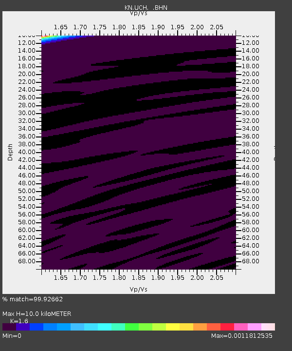
| Estimated Moho Depth: |
10.0 km |
| Estimated Crust Vp/Vs: |
1.60 |
| Assumed Crust Vp: |
6.306 km/s |
| Estimated Crust Vs: |
3.941 km/s |
| Estimated Crust Poisson's Ratio: |
0.18 |
|
| Radial Match: |
99.92662 % |
| Radial Bump: |
10 |
| Transverse Match: |
99.788414 % |
| Transverse Bump: |
26 |
| SOD ConfigId: |
2564 |
| Insert Time: |
2010-03-08 21:31:04.756 +0000 |
| GWidth: |
2.5 |
| Max Bumps: |
400 |
| Tol: |
0.001 |
|

Signal To Noise
| Channel | StoN | STA | LTA |
| KN:UCH: :BHN:20070929T06:52:01.499006Z | 1.186354 | 2.2481373E-7 | 1.894997E-7 |
| KN:UCH: :BHE:20070929T06:52:01.499006Z | 0.7688315 | 2.2581646E-7 | 2.9371387E-7 |
| KN:UCH: :BHZ:20070929T06:52:01.499006Z | 1.0570835 | 3.2594406E-7 | 3.083428E-7 |
| Arrivals |
| Ps | 1.0 SECOND |
| PpPs | 3.9 SECOND |
| PsPs/PpSs | 4.9 SECOND |


