UCH KN.UCH - Earthquake Result Viewer
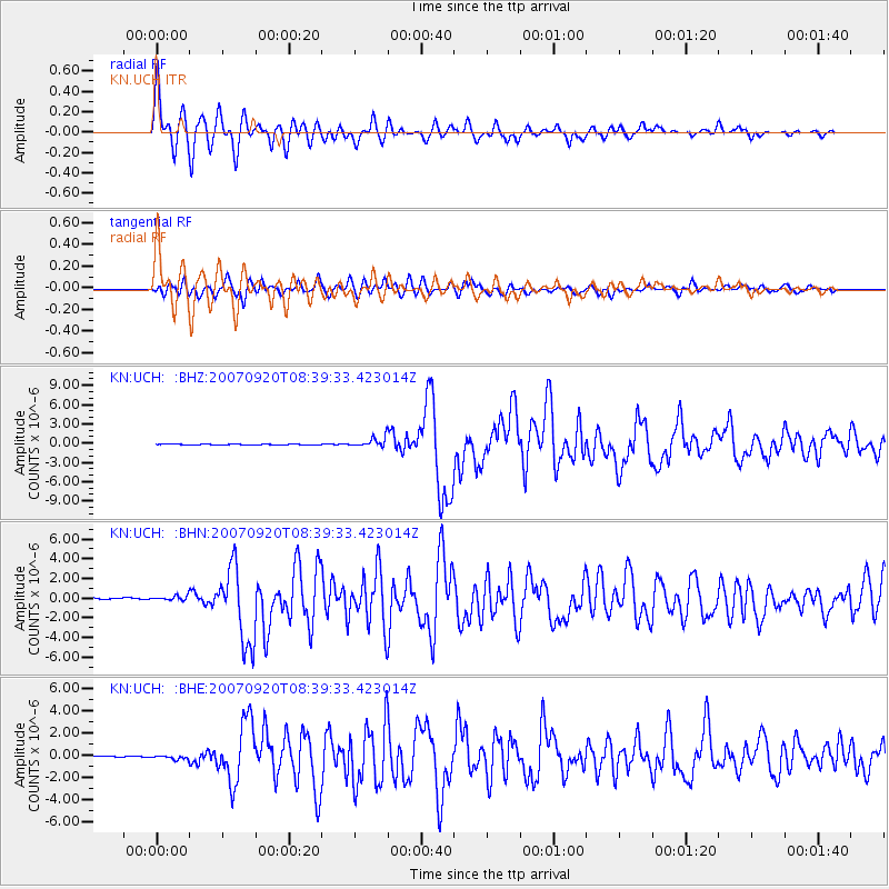
Earthquake location: Southern Sumatra, Indonesia
Earthquake latitude/longitude: -2.0/100.1
Earthquake time(UTC): 2007/09/20 (263) 08:31:14 GMT
Earthquake Depth: 30 km
Earthquake Magnitude: 6.3 MB, 6.8 MS, 6.7 MW, 6.3 ME
Earthquake Catalog/Contributor: WHDF/NEIC
Network: KN Kyrgyz Seismic Telemetry Network
Station: UCH KN.UCH
Lat/Lon: 42.23 N/74.51 E
Elevation: 3850 m
Distance: 49.8 deg
Az: 335.111 deg
Baz: 145.507 deg
Ray Param: 0.068445235
Estimated Moho Depth: 32.5 km
Estimated Crust Vp/Vs: 1.75
Assumed Crust Vp: 6.306 km/s
Estimated Crust Vs: 3.609 km/s
Estimated Crust Poisson's Ratio: 0.26
Radial Match: 95.283356 %
Radial Bump: 400
Transverse Match: 88.479 %
Transverse Bump: 400
SOD ConfigId: 2564
Insert Time: 2010-03-08 21:31:15.418 +0000
GWidth: 2.5
Max Bumps: 400
Tol: 0.001

Signal To Noise

ChannelStoNSTALTA
KN:UCH: :BHN:20070920T08:39:33.423014Z1.35956752.9564626E-72.174561E-7
KN:UCH: :BHE:20070920T08:39:33.423014Z1.74258021.7209467E-79.8758534E-8
KN:UCH: :BHZ:20070920T08:39:33.423014Z11.6431687.550754E-76.485137E-8
Arrivals
Ps4.1 SECOND
PpPs13 SECOND
PsPs/PpSs17 SECOND