You are here: Home > Network List > CN - Canadian National Seismograph Network Stations List
> Station INK INUVIK, NT > Earthquake Result Viewer
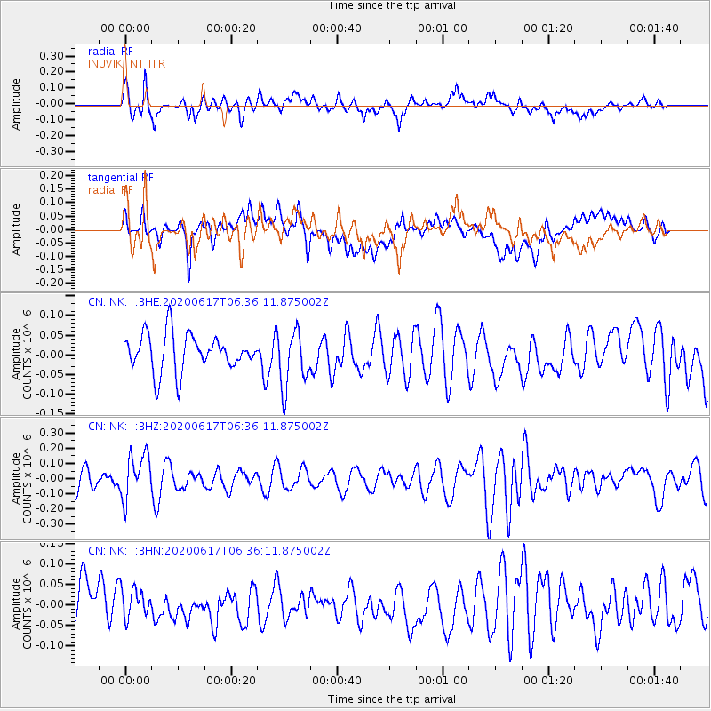
INK INUVIK, NT - Earthquake Result Viewer
*The percent match for this event was below the threshold and hence no stack was calculated.
| Earthquake location: |
Tonga Islands |
| Earthquake latitude/longitude: |
-16.1/-175.0 |
| Earthquake time(UTC): |
2020/06/17 (169) 06:24:18 GMT |
| Earthquake Depth: |
280 km |
| Earthquake Magnitude: |
5.6 Mww |
| Earthquake Catalog/Contributor: |
NEIC PDE/us |
|
| Network: |
CN Canadian National Seismograph Network |
| Station: |
INK INUVIK, NT |
| Lat/Lon: |
68.31 N/133.53 W |
| Elevation: |
44 m |
|
| Distance: |
89.4 deg |
| Az: |
14.251 deg |
| Baz: |
219.52 deg |
| Ray Param: |
$rayparam |
*The percent match for this event was below the threshold and hence was not used in the summary stack. |
|
| Radial Match: |
61.36703 % |
| Radial Bump: |
400 |
| Transverse Match: |
42.60976 % |
| Transverse Bump: |
400 |
| SOD ConfigId: |
21709731 |
| Insert Time: |
2020-07-01 06:32:51.872 +0000 |
| GWidth: |
2.5 |
| Max Bumps: |
400 |
| Tol: |
0.001 |
|
Signal To Noise
| Channel | StoN | STA | LTA |
| CN:INK: :BHZ:20200617T06:36:11.875002Z | 2.2291374 | 1.5089807E-7 | 6.7693485E-8 |
| CN:INK: :BHN:20200617T06:36:11.875002Z | 0.71263427 | 3.494277E-8 | 4.9033243E-8 |
| CN:INK: :BHE:20200617T06:36:11.875002Z | 1.5693041 | 7.3876905E-8 | 4.707622E-8 |
| Arrivals |
| Ps | |
| PpPs | |
| PsPs/PpSs | |


