You are here: Home > Network List > IU - Global Seismograph Network (GSN - IRIS/USGS) Stations List
> Station PMG Port Moresby, New Guinea > Earthquake Result Viewer
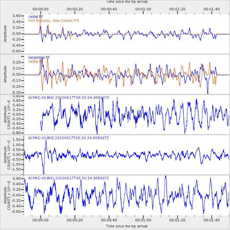
PMG Port Moresby, New Guinea - Earthquake Result Viewer
*The percent match for this event was below the threshold and hence no stack was calculated.
| Earthquake location: |
Tonga Islands |
| Earthquake latitude/longitude: |
-16.1/-175.0 |
| Earthquake time(UTC): |
2020/06/17 (169) 06:24:18 GMT |
| Earthquake Depth: |
280 km |
| Earthquake Magnitude: |
5.6 Mww |
| Earthquake Catalog/Contributor: |
NEIC PDE/us |
|
| Network: |
IU Global Seismograph Network (GSN - IRIS/USGS) |
| Station: |
PMG Port Moresby, New Guinea |
| Lat/Lon: |
9.40 S/147.16 E |
| Elevation: |
90 m |
|
| Distance: |
37.5 deg |
| Az: |
275.587 deg |
| Baz: |
104.219 deg |
| Ray Param: |
$rayparam |
*The percent match for this event was below the threshold and hence was not used in the summary stack. |
|
| Radial Match: |
52.22683 % |
| Radial Bump: |
400 |
| Transverse Match: |
48.63636 % |
| Transverse Bump: |
400 |
| SOD ConfigId: |
21709731 |
| Insert Time: |
2020-07-01 06:35:17.299 +0000 |
| GWidth: |
2.5 |
| Max Bumps: |
400 |
| Tol: |
0.001 |
|
Signal To Noise
| Channel | StoN | STA | LTA |
| IU:PMG:00:BHZ:20200617T06:30:34.968997Z | 2.8442793 | 8.07984E-7 | 2.8407337E-7 |
| IU:PMG:00:BH1:20200617T06:30:34.968997Z | 0.98283434 | 2.5613474E-7 | 2.6060826E-7 |
| IU:PMG:00:BH2:20200617T06:30:34.968997Z | 1.2554802 | 3.7371072E-7 | 2.9766358E-7 |
| Arrivals |
| Ps | |
| PpPs | |
| PsPs/PpSs | |


