You are here: Home > Network List > TA - USArray Transportable Network (new EarthScope stations) Stations List
> Station F21K Alatna River, AK, USA > Earthquake Result Viewer
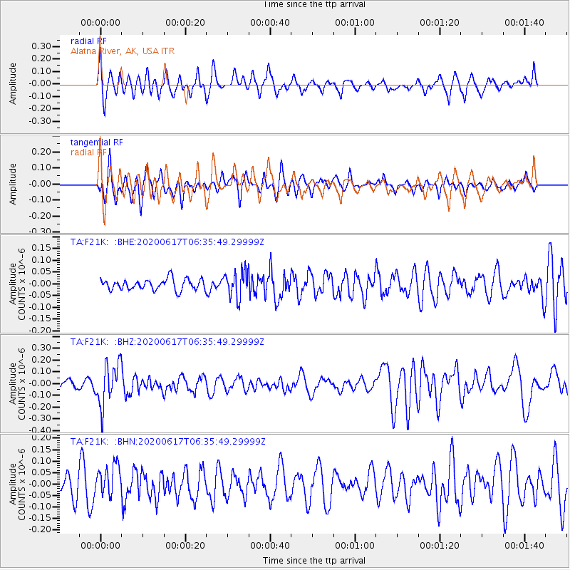
F21K Alatna River, AK, USA - Earthquake Result Viewer
*The percent match for this event was below the threshold and hence no stack was calculated.
| Earthquake location: |
Tonga Islands |
| Earthquake latitude/longitude: |
-16.1/-175.0 |
| Earthquake time(UTC): |
2020/06/17 (169) 06:24:18 GMT |
| Earthquake Depth: |
280 km |
| Earthquake Magnitude: |
5.6 Mww |
| Earthquake Catalog/Contributor: |
NEIC PDE/us |
|
| Network: |
TA USArray Transportable Network (new EarthScope stations) |
| Station: |
F21K Alatna River, AK, USA |
| Lat/Lon: |
67.22 N/153.48 W |
| Elevation: |
597 m |
|
| Distance: |
84.6 deg |
| Az: |
8.241 deg |
| Baz: |
200.72 deg |
| Ray Param: |
$rayparam |
*The percent match for this event was below the threshold and hence was not used in the summary stack. |
|
| Radial Match: |
64.439606 % |
| Radial Bump: |
400 |
| Transverse Match: |
61.98709 % |
| Transverse Bump: |
383 |
| SOD ConfigId: |
21709731 |
| Insert Time: |
2020-07-01 06:40:47.841 +0000 |
| GWidth: |
2.5 |
| Max Bumps: |
400 |
| Tol: |
0.001 |
|
Signal To Noise
| Channel | StoN | STA | LTA |
| TA:F21K: :BHZ:20200617T06:35:49.29999Z | 4.4114532 | 1.8451115E-7 | 4.182548E-8 |
| TA:F21K: :BHN:20200617T06:35:49.29999Z | 2.0718296 | 7.0775144E-8 | 3.41607E-8 |
| TA:F21K: :BHE:20200617T06:35:49.29999Z | 2.4757175 | 5.680072E-8 | 2.2943134E-8 |
| Arrivals |
| Ps | |
| PpPs | |
| PsPs/PpSs | |


