You are here: Home > Network List > TA - USArray Transportable Network (new EarthScope stations) Stations List
> Station G31M Satah River, YT, CAN > Earthquake Result Viewer
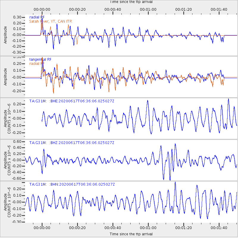
G31M Satah River, YT, CAN - Earthquake Result Viewer
*The percent match for this event was below the threshold and hence no stack was calculated.
| Earthquake location: |
Tonga Islands |
| Earthquake latitude/longitude: |
-16.1/-175.0 |
| Earthquake time(UTC): |
2020/06/17 (169) 06:24:18 GMT |
| Earthquake Depth: |
280 km |
| Earthquake Magnitude: |
5.6 Mww |
| Earthquake Catalog/Contributor: |
NEIC PDE/us |
|
| Network: |
TA USArray Transportable Network (new EarthScope stations) |
| Station: |
G31M Satah River, YT, CAN |
| Lat/Lon: |
66.92 N/134.27 W |
| Elevation: |
61 m |
|
| Distance: |
88.1 deg |
| Az: |
14.908 deg |
| Baz: |
218.846 deg |
| Ray Param: |
$rayparam |
*The percent match for this event was below the threshold and hence was not used in the summary stack. |
|
| Radial Match: |
59.54932 % |
| Radial Bump: |
271 |
| Transverse Match: |
45.655403 % |
| Transverse Bump: |
400 |
| SOD ConfigId: |
21709731 |
| Insert Time: |
2020-07-01 06:41:13.935 +0000 |
| GWidth: |
2.5 |
| Max Bumps: |
400 |
| Tol: |
0.001 |
|
Signal To Noise
| Channel | StoN | STA | LTA |
| TA:G31M: :BHZ:20200617T06:36:06.025027Z | 2.8365543 | 2.0379304E-7 | 7.1845285E-8 |
| TA:G31M: :BHN:20200617T06:36:06.025027Z | 1.092483 | 7.55535E-8 | 6.915759E-8 |
| TA:G31M: :BHE:20200617T06:36:06.025027Z | 1.4723074 | 8.3251116E-8 | 5.6544657E-8 |
| Arrivals |
| Ps | |
| PpPs | |
| PsPs/PpSs | |


