UCH KN.UCH - Earthquake Result Viewer
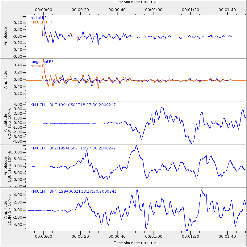
Earthquake location: South Of Java, Indonesia
Earthquake latitude/longitude: -10.5/113.0
Earthquake time(UTC): 1994/06/02 (153) 18:17:36 GMT
Earthquake Depth: 39 km
Earthquake Magnitude: 5.5 MB, 7.2 MS, 6.8 UNKNOWN, 7.7 MW
Earthquake Catalog/Contributor: WHDF/NEIC
Network: KN Kyrgyz Seismic Telemetry Network
Station: UCH KN.UCH
Lat/Lon: 42.23 N/74.51 E
Elevation: 3850 m
Distance: 63.2 deg
Az: 328.827 deg
Baz: 136.727 deg
Ray Param: 0.059667718
Estimated Moho Depth: 10.5 km
Estimated Crust Vp/Vs: 1.63
Assumed Crust Vp: 6.306 km/s
Estimated Crust Vs: 3.863 km/s
Estimated Crust Poisson's Ratio: 0.20
Radial Match: 95.14769 %
Radial Bump: 400
Transverse Match: 80.8222 %
Transverse Bump: 400
SOD ConfigId: 4480
Insert Time: 2010-03-08 21:32:15.661 +0000
GWidth: 2.5
Max Bumps: 400
Tol: 0.001

Signal To Noise

ChannelStoNSTALTA
KN:UCH: :BHZ:19940602T18:27:30.200024Z3.05289132.5110398E-78.2251205E-8
KN:UCH: :BHN:19940602T18:27:30.200024Z1.71825958.6132054E-85.01275E-8
KN:UCH: :BHE:19940602T18:27:30.200024Z3.00617368.957628E-82.9797443E-8
Arrivals
Ps1.1 SECOND
PpPs4.2 SECOND
PsPs/PpSs5.3 SECOND