You are here: Home > Network List > WY - Yellowstone Wyoming Seismic Network Stations List
> Station YHH Holmes Hill, YNP, WY, USA > Earthquake Result Viewer
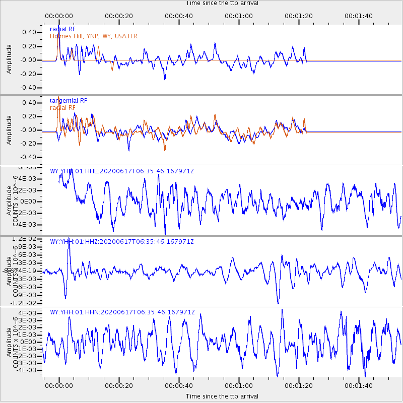
YHH Holmes Hill, YNP, WY, USA - Earthquake Result Viewer
*The percent match for this event was below the threshold and hence no stack was calculated.
| Earthquake location: |
Tonga Islands |
| Earthquake latitude/longitude: |
-16.1/-175.0 |
| Earthquake time(UTC): |
2020/06/17 (169) 06:24:18 GMT |
| Earthquake Depth: |
280 km |
| Earthquake Magnitude: |
5.6 Mww |
| Earthquake Catalog/Contributor: |
NEIC PDE/us |
|
| Network: |
WY Yellowstone Wyoming Seismic Network |
| Station: |
YHH Holmes Hill, YNP, WY, USA |
| Lat/Lon: |
44.79 N/110.85 W |
| Elevation: |
2717 m |
|
| Distance: |
84.0 deg |
| Az: |
40.111 deg |
| Baz: |
240.407 deg |
| Ray Param: |
$rayparam |
*The percent match for this event was below the threshold and hence was not used in the summary stack. |
|
| Radial Match: |
58.698788 % |
| Radial Bump: |
400 |
| Transverse Match: |
53.44263 % |
| Transverse Bump: |
400 |
| SOD ConfigId: |
21709731 |
| Insert Time: |
2020-07-01 06:45:48.865 +0000 |
| GWidth: |
2.5 |
| Max Bumps: |
400 |
| Tol: |
0.001 |
|
Signal To Noise
| Channel | StoN | STA | LTA |
| WY:YHH:01:HHZ:20200617T06:35:46.167971Z | 2.4380398 | 4.9686792E-9 | 2.0379811E-9 |
| WY:YHH:01:HHN:20200617T06:35:46.167971Z | 1.1447383 | 1.7667614E-9 | 1.5433758E-9 |
| WY:YHH:01:HHE:20200617T06:35:46.167971Z | 0.9919405 | 2.5127942E-9 | 2.5332108E-9 |
| Arrivals |
| Ps | |
| PpPs | |
| PsPs/PpSs | |


