You are here: Home > Network List > KN - Kyrgyz Seismic Telemetry Network Stations List
> Station UCH KN.UCH > Earthquake Result Viewer
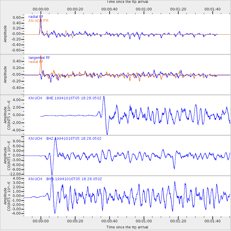
UCH KN.UCH - Earthquake Result Viewer
*The percent match for this event was below the threshold and hence no stack was calculated.
| Earthquake location: |
Kuril Islands |
| Earthquake latitude/longitude: |
45.7/149.2 |
| Earthquake time(UTC): |
1994/10/16 (289) 05:10:03 GMT |
| Earthquake Depth: |
139 km |
| Earthquake Magnitude: |
6.3 MB, 6.8 UNKNOWN, 6.7 MW |
| Earthquake Catalog/Contributor: |
WHDF/NEIC |
|
| Network: |
KN Kyrgyz Seismic Telemetry Network |
| Station: |
UCH KN.UCH |
| Lat/Lon: |
42.23 N/74.51 E |
| Elevation: |
3850 m |
|
| Distance: |
52.0 deg |
| Az: |
294.673 deg |
| Baz: |
58.962 deg |
| Ray Param: |
$rayparam |
*The percent match for this event was below the threshold and hence was not used in the summary stack. |
|
| Radial Match: |
78.931885 % |
| Radial Bump: |
400 |
| Transverse Match: |
66.26814 % |
| Transverse Bump: |
381 |
| SOD ConfigId: |
4480 |
| Insert Time: |
2010-03-08 21:32:59.535 +0000 |
| GWidth: |
2.5 |
| Max Bumps: |
400 |
| Tol: |
0.001 |
|
Signal To Noise
| Channel | StoN | STA | LTA |
| KN:UCH: :BHZ:19941016T05:18:28.050Z | 20.263937 | 9.4974786E-7 | 4.686887E-8 |
| KN:UCH: :BHN:19941016T05:18:28.050Z | 1.2431755 | 2.9960904E-7 | 2.4100302E-7 |
| KN:UCH: :BHE:19941016T05:18:28.050Z | 5.587195 | 4.3724083E-7 | 7.825766E-8 |
| Arrivals |
| Ps | |
| PpPs | |
| PsPs/PpSs | |


