You are here: Home > Network List > G - GEOSCOPE Stations List
> Station CLF Chambon la Foret observatory, France > Earthquake Result Viewer
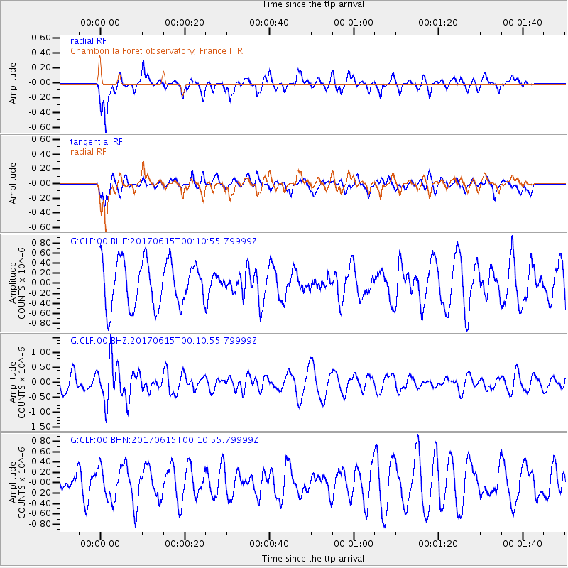
CLF Chambon la Foret observatory, France - Earthquake Result Viewer
*The percent match for this event was below the threshold and hence no stack was calculated.
| Earthquake location: |
Near Coast Of Oaxaca, Mexico |
| Earthquake latitude/longitude: |
15.4/-97.1 |
| Earthquake time(UTC): |
2017/06/14 (165) 23:58:52 GMT |
| Earthquake Depth: |
6.9 km |
| Earthquake Magnitude: |
5.5 Mww |
| Earthquake Catalog/Contributor: |
NEIC PDE/us |
|
| Network: |
G GEOSCOPE |
| Station: |
CLF Chambon la Foret observatory, France |
| Lat/Lon: |
48.03 N/2.26 E |
| Elevation: |
145 m |
|
| Distance: |
84.8 deg |
| Az: |
41.687 deg |
| Baz: |
287.095 deg |
| Ray Param: |
$rayparam |
*The percent match for this event was below the threshold and hence was not used in the summary stack. |
|
| Radial Match: |
62.983532 % |
| Radial Bump: |
400 |
| Transverse Match: |
39.907944 % |
| Transverse Bump: |
313 |
| SOD ConfigId: |
2140511 |
| Insert Time: |
2017-06-28 15:50:52.049 +0000 |
| GWidth: |
2.5 |
| Max Bumps: |
400 |
| Tol: |
0.001 |
|
Signal To Noise
| Channel | StoN | STA | LTA |
| G:CLF:00:BHZ:20170615T00:10:55.79999Z | 2.4472275 | 7.004269E-7 | 2.862124E-7 |
| G:CLF:00:BHN:20170615T00:10:55.79999Z | 1.23002 | 3.0179473E-7 | 2.4535757E-7 |
| G:CLF:00:BHE:20170615T00:10:55.79999Z | 0.39115572 | 1.7423096E-7 | 4.454261E-7 |
| Arrivals |
| Ps | |
| PpPs | |
| PsPs/PpSs | |


