You are here: Home > Network List > PS - Pacific21 Stations List
> Station PSI Parapat, Indonesia > Earthquake Result Viewer
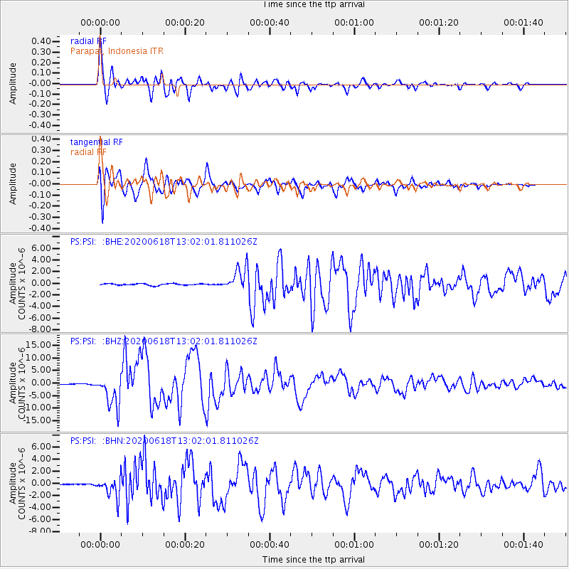
PSI Parapat, Indonesia - Earthquake Result Viewer

| Earthquake location: |
South Of Kermadec Islands |
| Earthquake latitude/longitude: |
-33.3/-177.8 |
| Earthquake time(UTC): |
2020/06/18 (170) 12:49:53 GMT |
| Earthquake Depth: |
10 km |
| Earthquake Magnitude: |
7.4 Mww |
| Earthquake Catalog/Contributor: |
NEIC PDE/us |
|
| Network: |
PS Pacific21 |
| Station: |
PSI Parapat, Indonesia |
| Lat/Lon: |
2.69 N/98.92 E |
| Elevation: |
987 m |
|
| Distance: |
85.8 deg |
| Az: |
275.949 deg |
| Baz: |
123.493 deg |
| Ray Param: |
0.04449571 |
| Estimated Moho Depth: |
22.25 km |
| Estimated Crust Vp/Vs: |
1.79 |
| Assumed Crust Vp: |
6.468 km/s |
| Estimated Crust Vs: |
3.618 km/s |
| Estimated Crust Poisson's Ratio: |
0.27 |
|
| Radial Match: |
96.48906 % |
| Radial Bump: |
400 |
| Transverse Match: |
96.469536 % |
| Transverse Bump: |
400 |
| SOD ConfigId: |
21709731 |
| Insert Time: |
2020-07-02 13:06:34.069 +0000 |
| GWidth: |
2.5 |
| Max Bumps: |
400 |
| Tol: |
0.001 |
|
Signal To Noise
| Channel | StoN | STA | LTA |
| PS:PSI: :BHZ:20200618T13:02:01.811026Z | 51.892166 | 6.6231505E-6 | 1.2763296E-7 |
| PS:PSI: :BHN:20200618T13:02:01.811026Z | 19.258247 | 1.6798854E-6 | 8.72294E-8 |
| PS:PSI: :BHE:20200618T13:02:01.811026Z | 14.490367 | 2.0883085E-6 | 1.4411702E-7 |
| Arrivals |
| Ps | 2.8 SECOND |
| PpPs | 9.4 SECOND |
| PsPs/PpSs | 12 SECOND |


