You are here: Home > Network List > WY - Yellowstone Wyoming Seismic Network Stations List
> Station YPP Pitchstone Plateau, YNP, WY, USA > Earthquake Result Viewer
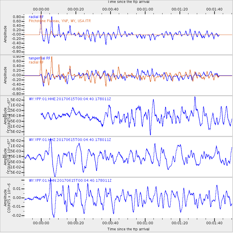
YPP Pitchstone Plateau, YNP, WY, USA - Earthquake Result Viewer
*The percent match for this event was below the threshold and hence no stack was calculated.
| Earthquake location: |
Near Coast Of Oaxaca, Mexico |
| Earthquake latitude/longitude: |
15.4/-97.1 |
| Earthquake time(UTC): |
2017/06/14 (165) 23:58:52 GMT |
| Earthquake Depth: |
6.9 km |
| Earthquake Magnitude: |
5.5 Mww |
| Earthquake Catalog/Contributor: |
NEIC PDE/us |
|
| Network: |
WY Yellowstone Wyoming Seismic Network |
| Station: |
YPP Pitchstone Plateau, YNP, WY, USA |
| Lat/Lon: |
44.27 N/110.80 W |
| Elevation: |
2707 m |
|
| Distance: |
31.1 deg |
| Az: |
340.736 deg |
| Baz: |
153.7 deg |
| Ray Param: |
$rayparam |
*The percent match for this event was below the threshold and hence was not used in the summary stack. |
|
| Radial Match: |
75.50679 % |
| Radial Bump: |
400 |
| Transverse Match: |
70.06634 % |
| Transverse Bump: |
400 |
| SOD ConfigId: |
2140511 |
| Insert Time: |
2017-06-28 15:54:08.321 +0000 |
| GWidth: |
2.5 |
| Max Bumps: |
400 |
| Tol: |
0.001 |
|
Signal To Noise
| Channel | StoN | STA | LTA |
| WY:YPP:01:HHZ:20170615T00:04:40.178011Z | 3.769182 | 4.174266E-9 | 1.1074726E-9 |
| WY:YPP:01:HHN:20170615T00:04:40.178011Z | 1.9948416 | 2.9744023E-9 | 1.491047E-9 |
| WY:YPP:01:HHE:20170615T00:04:40.178011Z | 1.9986334 | 4.432142E-9 | 2.2175863E-9 |
| Arrivals |
| Ps | |
| PpPs | |
| PsPs/PpSs | |


