You are here: Home > Network List > TA - USArray Transportable Network (new EarthScope stations) Stations List
> Station I17K Unalakleet, AK, USA > Earthquake Result Viewer
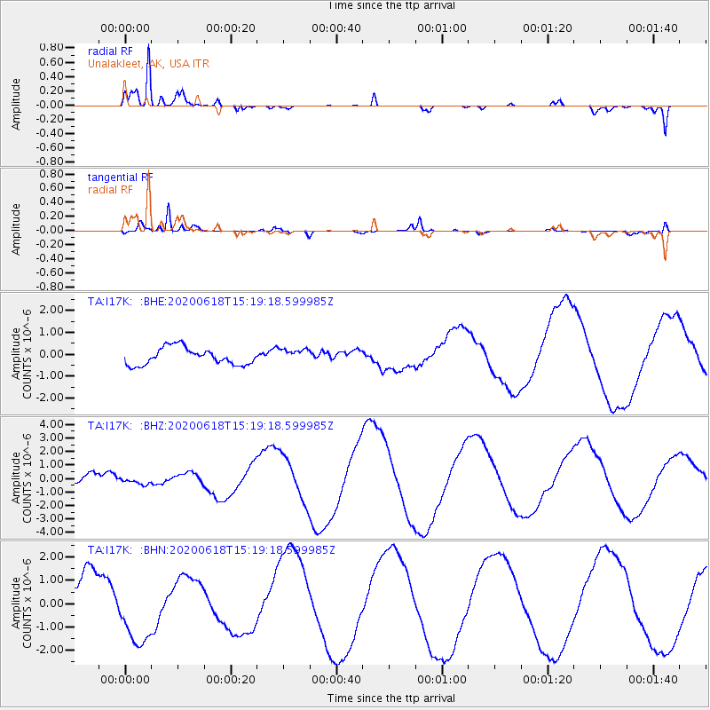
I17K Unalakleet, AK, USA - Earthquake Result Viewer
*The percent match for this event was below the threshold and hence no stack was calculated.
| Earthquake location: |
South Of Kermadec Islands |
| Earthquake latitude/longitude: |
-33.2/-178.0 |
| Earthquake time(UTC): |
2020/06/18 (170) 15:06:15 GMT |
| Earthquake Depth: |
10 km |
| Earthquake Magnitude: |
5.5 mb |
| Earthquake Catalog/Contributor: |
NEIC PDE/us |
|
| Network: |
TA USArray Transportable Network (new EarthScope stations) |
| Station: |
I17K Unalakleet, AK, USA |
| Lat/Lon: |
63.89 N/160.70 W |
| Elevation: |
105 m |
|
| Distance: |
97.7 deg |
| Az: |
7.624 deg |
| Baz: |
194.563 deg |
| Ray Param: |
$rayparam |
*The percent match for this event was below the threshold and hence was not used in the summary stack. |
|
| Radial Match: |
90.356316 % |
| Radial Bump: |
341 |
| Transverse Match: |
88.61349 % |
| Transverse Bump: |
249 |
| SOD ConfigId: |
21709731 |
| Insert Time: |
2020-07-02 15:14:58.008 +0000 |
| GWidth: |
2.5 |
| Max Bumps: |
400 |
| Tol: |
0.001 |
|
Signal To Noise
| Channel | StoN | STA | LTA |
| TA:I17K: :BHZ:20200618T15:19:18.599985Z | 1.0141271 | 2.7568296E-7 | 2.7184262E-7 |
| TA:I17K: :BHN:20200618T15:19:18.599985Z | 1.6715456 | 1.5176587E-6 | 9.0793736E-7 |
| TA:I17K: :BHE:20200618T15:19:18.599985Z | 0.8005129 | 3.1072494E-7 | 3.8815733E-7 |
| Arrivals |
| Ps | |
| PpPs | |
| PsPs/PpSs | |


