You are here: Home > Network List > TA - USArray Transportable Network (new EarthScope stations) Stations List
> Station M16K Timber Creek, AK, USA > Earthquake Result Viewer
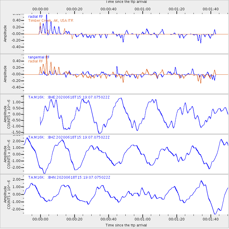
M16K Timber Creek, AK, USA - Earthquake Result Viewer
*The percent match for this event was below the threshold and hence no stack was calculated.
| Earthquake location: |
South Of Kermadec Islands |
| Earthquake latitude/longitude: |
-33.2/-178.0 |
| Earthquake time(UTC): |
2020/06/18 (170) 15:06:15 GMT |
| Earthquake Depth: |
10 km |
| Earthquake Magnitude: |
5.5 mb |
| Earthquake Catalog/Contributor: |
NEIC PDE/us |
|
| Network: |
TA USArray Transportable Network (new EarthScope stations) |
| Station: |
M16K Timber Creek, AK, USA |
| Lat/Lon: |
61.02 N/158.96 W |
| Elevation: |
394 m |
|
| Distance: |
95.1 deg |
| Az: |
9.168 deg |
| Baz: |
195.928 deg |
| Ray Param: |
$rayparam |
*The percent match for this event was below the threshold and hence was not used in the summary stack. |
|
| Radial Match: |
86.66972 % |
| Radial Bump: |
400 |
| Transverse Match: |
72.555855 % |
| Transverse Bump: |
400 |
| SOD ConfigId: |
21709731 |
| Insert Time: |
2020-07-02 15:15:03.526 +0000 |
| GWidth: |
2.5 |
| Max Bumps: |
400 |
| Tol: |
0.001 |
|
Signal To Noise
| Channel | StoN | STA | LTA |
| TA:M16K: :BHZ:20200618T15:19:07.075022Z | 1.7633389 | 2.4618002E-6 | 1.3961015E-6 |
| TA:M16K: :BHN:20200618T15:19:07.075022Z | 0.46744162 | 5.768851E-7 | 1.2341329E-6 |
| TA:M16K: :BHE:20200618T15:19:07.075022Z | 1.1264008 | 8.935487E-7 | 7.9327776E-7 |
| Arrivals |
| Ps | |
| PpPs | |
| PsPs/PpSs | |


