You are here: Home > Network List > CI - Caltech Regional Seismic Network Stations List
> Station GLA Glamis, Glamis, CA, USA > Earthquake Result Viewer
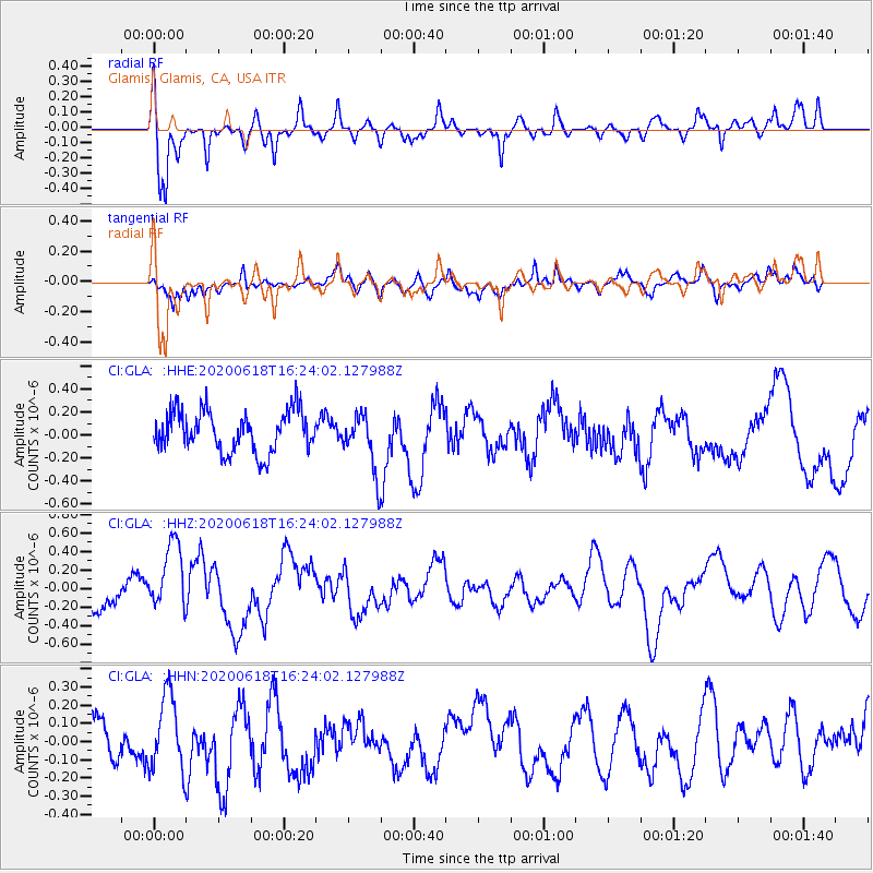
GLA Glamis, Glamis, CA, USA - Earthquake Result Viewer
*The percent match for this event was below the threshold and hence no stack was calculated.
| Earthquake location: |
South Of Kermadec Islands |
| Earthquake latitude/longitude: |
-33.3/-177.9 |
| Earthquake time(UTC): |
2020/06/18 (170) 16:11:39 GMT |
| Earthquake Depth: |
10 km |
| Earthquake Magnitude: |
5.5 mb |
| Earthquake Catalog/Contributor: |
NEIC PDE/us |
|
| Network: |
CI Caltech Regional Seismic Network |
| Station: |
GLA Glamis, Glamis, CA, USA |
| Lat/Lon: |
33.05 N/114.83 W |
| Elevation: |
610 m |
|
| Distance: |
88.7 deg |
| Az: |
48.529 deg |
| Baz: |
228.38 deg |
| Ray Param: |
$rayparam |
*The percent match for this event was below the threshold and hence was not used in the summary stack. |
|
| Radial Match: |
64.0027 % |
| Radial Bump: |
322 |
| Transverse Match: |
68.968475 % |
| Transverse Bump: |
378 |
| SOD ConfigId: |
21709731 |
| Insert Time: |
2020-07-02 16:17:31.111 +0000 |
| GWidth: |
2.5 |
| Max Bumps: |
400 |
| Tol: |
0.001 |
|
Signal To Noise
| Channel | StoN | STA | LTA |
| CI:GLA: :HHZ:20200618T16:24:02.127988Z | 2.6864684 | 3.9101968E-7 | 1.4555158E-7 |
| CI:GLA: :HHN:20200618T16:24:02.127988Z | 1.6010634 | 2.0753203E-7 | 1.2962137E-7 |
| CI:GLA: :HHE:20200618T16:24:02.127988Z | 1.3970081 | 2.4966002E-7 | 1.7871051E-7 |
| Arrivals |
| Ps | |
| PpPs | |
| PsPs/PpSs | |


