ULHL KN.ULHL - Earthquake Result Viewer
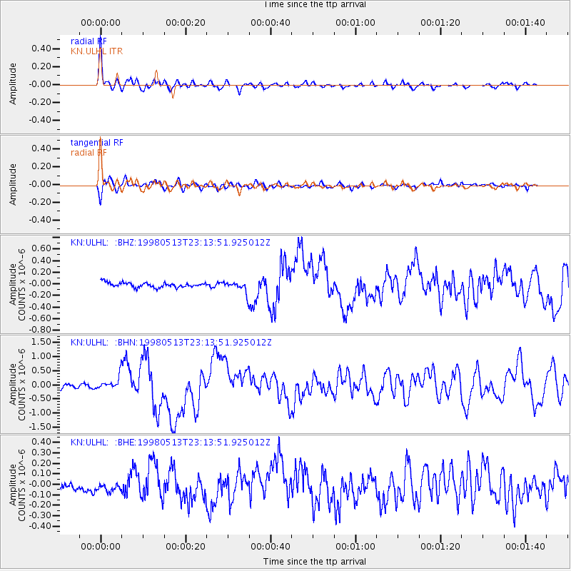
Earthquake location: New Britain Region, P.N.G.
Earthquake latitude/longitude: -5.1/151.7
Earthquake time(UTC): 1998/05/13 (133) 23:02:05 GMT
Earthquake Depth: 61 km
Earthquake Magnitude: 6.0 MB, 6.6 UNKNOWN, 5.9 ME
Earthquake Catalog/Contributor: WHDF/NEIC
Network: KN Kyrgyz Seismic Telemetry Network
Station: ULHL KN.ULHL
Lat/Lon: 42.25 N/76.24 E
Elevation: 2040 m
Distance: 82.8 deg
Az: 313.57 deg
Baz: 103.615 deg
Ray Param: 0.046541184
Estimated Moho Depth: 61.75 km
Estimated Crust Vp/Vs: 1.70
Assumed Crust Vp: 6.306 km/s
Estimated Crust Vs: 3.709 km/s
Estimated Crust Poisson's Ratio: 0.24
Radial Match: 94.02207 %
Radial Bump: 363
Transverse Match: 81.22179 %
Transverse Bump: 400
SOD ConfigId: 4480
Insert Time: 2010-03-08 21:41:41.977 +0000
GWidth: 2.5
Max Bumps: 400
Tol: 0.001

Signal To Noise

ChannelStoNSTALTA
KN:ULHL: :BHN:19980513T23:13:51.925012Z2.79584242.4064911E-78.607392E-8
KN:ULHL: :BHE:19980513T23:13:51.925012Z1.52250936.790773E-84.46025E-8
KN:ULHL: :BHZ:19980513T23:13:51.925012Z2.58930751.0473309E-74.04483E-8
Arrivals
Ps7.0 SECOND
PpPs26 SECOND
PsPs/PpSs33 SECOND