You are here: Home > Network List > CN - Canadian National Seismograph Network Stations List
> Station INK INUVIK, NT > Earthquake Result Viewer
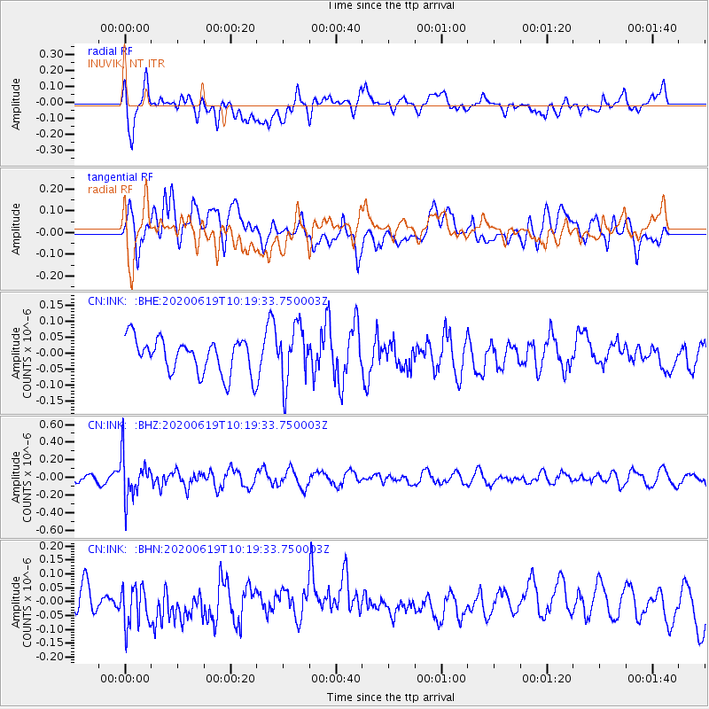
INK INUVIK, NT - Earthquake Result Viewer
*The percent match for this event was below the threshold and hence no stack was calculated.
| Earthquake location: |
Fiji Islands Region |
| Earthquake latitude/longitude: |
-17.5/-178.9 |
| Earthquake time(UTC): |
2020/06/19 (171) 10:07:55 GMT |
| Earthquake Depth: |
535 km |
| Earthquake Magnitude: |
5.6 Mww |
| Earthquake Catalog/Contributor: |
NEIC PDE/us |
|
| Network: |
CN Canadian National Seismograph Network |
| Station: |
INK INUVIK, NT |
| Lat/Lon: |
68.31 N/133.53 W |
| Elevation: |
44 m |
|
| Distance: |
91.6 deg |
| Az: |
15.354 deg |
| Baz: |
222.828 deg |
| Ray Param: |
$rayparam |
*The percent match for this event was below the threshold and hence was not used in the summary stack. |
|
| Radial Match: |
58.14087 % |
| Radial Bump: |
400 |
| Transverse Match: |
46.62665 % |
| Transverse Bump: |
400 |
| SOD ConfigId: |
21709731 |
| Insert Time: |
2020-07-03 10:19:17.458 +0000 |
| GWidth: |
2.5 |
| Max Bumps: |
400 |
| Tol: |
0.001 |
|
Signal To Noise
| Channel | StoN | STA | LTA |
| CN:INK: :BHZ:20200619T10:19:33.750003Z | 2.7690415 | 2.448762E-7 | 8.843356E-8 |
| CN:INK: :BHN:20200619T10:19:33.750003Z | 1.2761277 | 7.38051E-8 | 5.7835198E-8 |
| CN:INK: :BHE:20200619T10:19:33.750003Z | 1.6392436 | 8.918058E-8 | 5.4403493E-8 |
| Arrivals |
| Ps | |
| PpPs | |
| PsPs/PpSs | |


