ULHL KN.ULHL - Earthquake Result Viewer
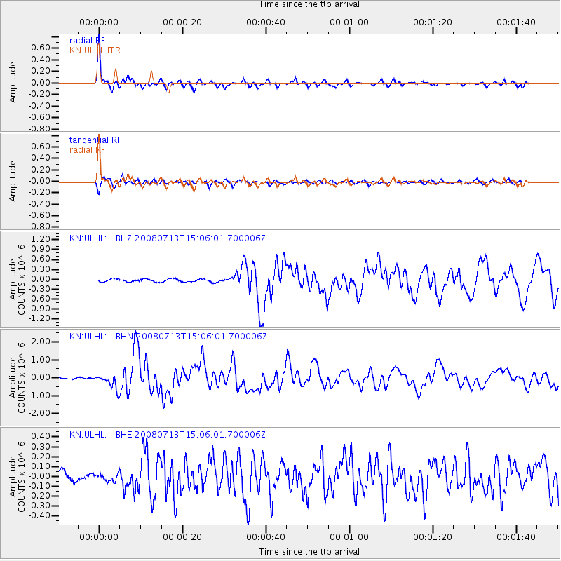
Earthquake location: Taiwan Region
Earthquake latitude/longitude: 21.0/121.1
Earthquake time(UTC): 2008/07/13 (195) 14:58:32 GMT
Earthquake Depth: 10 km
Earthquake Magnitude: 5.6 MB, 6.3 MS, 6.2 MW, 6.1 MW
Earthquake Catalog/Contributor: WHDF/NEIC
Network: KN Kyrgyz Seismic Telemetry Network
Station: ULHL KN.ULHL
Lat/Lon: 42.25 N/76.24 E
Elevation: 2040 m
Distance: 43.1 deg
Az: 309.908 deg
Baz: 105.156 deg
Ray Param: 0.07277028
Estimated Moho Depth: 50.75 km
Estimated Crust Vp/Vs: 1.83
Assumed Crust Vp: 6.306 km/s
Estimated Crust Vs: 3.441 km/s
Estimated Crust Poisson's Ratio: 0.29
Radial Match: 94.66348 %
Radial Bump: 400
Transverse Match: 75.25667 %
Transverse Bump: 400
SOD ConfigId: 2504
Insert Time: 2010-03-08 21:42:34.104 +0000
GWidth: 2.5
Max Bumps: 400
Tol: 0.001

Signal To Noise

ChannelStoNSTALTA
KN:ULHL: :BHN:20080713T15:06:01.700006Z10.1803864.159492E-74.08579E-8
KN:ULHL: :BHE:20080713T15:06:01.700006Z0.76453483.5275626E-84.6139988E-8
KN:ULHL: :BHZ:20080713T15:06:01.700006Z6.0054382.508603E-74.177219E-8
Arrivals
Ps7.1 SECOND
PpPs21 SECOND
PsPs/PpSs29 SECOND