You are here: Home > Network List > IU - Global Seismograph Network (GSN - IRIS/USGS) Stations List
> Station JOHN Johnston Island, USA > Earthquake Result Viewer
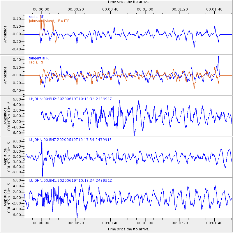
JOHN Johnston Island, USA - Earthquake Result Viewer
*The percent match for this event was below the threshold and hence no stack was calculated.
| Earthquake location: |
Fiji Islands Region |
| Earthquake latitude/longitude: |
-17.5/-178.9 |
| Earthquake time(UTC): |
2020/06/19 (171) 10:07:55 GMT |
| Earthquake Depth: |
535 km |
| Earthquake Magnitude: |
5.6 Mww |
| Earthquake Catalog/Contributor: |
NEIC PDE/us |
|
| Network: |
IU Global Seismograph Network (GSN - IRIS/USGS) |
| Station: |
JOHN Johnston Island, USA |
| Lat/Lon: |
16.73 N/169.53 W |
| Elevation: |
2.0 m |
|
| Distance: |
35.2 deg |
| Az: |
15.728 deg |
| Baz: |
195.667 deg |
| Ray Param: |
$rayparam |
*The percent match for this event was below the threshold and hence was not used in the summary stack. |
|
| Radial Match: |
65.80876 % |
| Radial Bump: |
400 |
| Transverse Match: |
48.218502 % |
| Transverse Bump: |
400 |
| SOD ConfigId: |
21709731 |
| Insert Time: |
2020-07-03 10:21:47.230 +0000 |
| GWidth: |
2.5 |
| Max Bumps: |
400 |
| Tol: |
0.001 |
|
Signal To Noise
| Channel | StoN | STA | LTA |
| IU:JOHN:00:BHZ:20200619T10:13:34.243991Z | 3.3279128 | 3.715958E-6 | 1.1166031E-6 |
| IU:JOHN:00:BH1:20200619T10:13:34.243991Z | 0.7003648 | 1.7192549E-6 | 2.454799E-6 |
| IU:JOHN:00:BH2:20200619T10:13:34.243991Z | 1.3478194 | 1.9860142E-6 | 1.4735016E-6 |
| Arrivals |
| Ps | |
| PpPs | |
| PsPs/PpSs | |


