You are here: Home > Network List > TA - USArray Transportable Network (new EarthScope stations) Stations List
> Station G22K Bettles, AK, USA > Earthquake Result Viewer
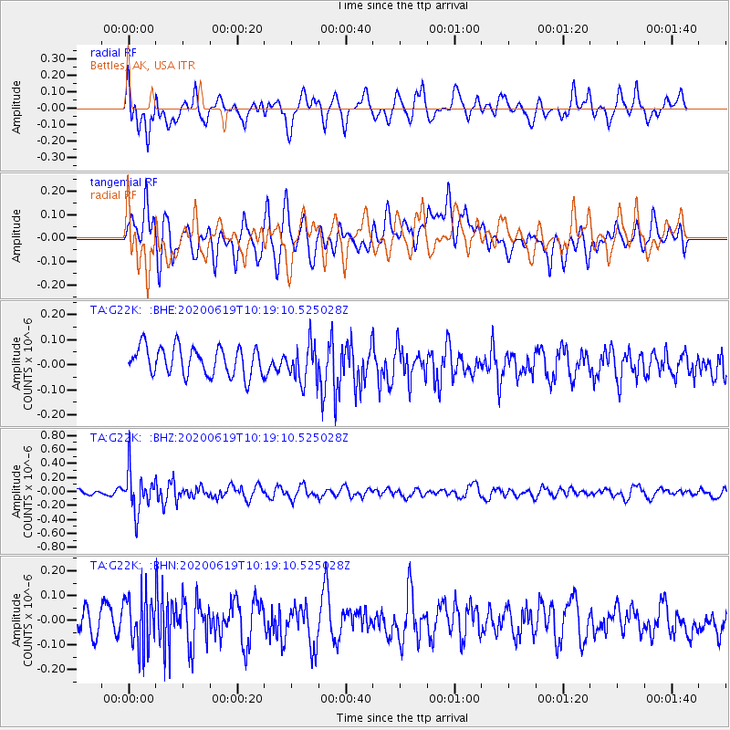
G22K Bettles, AK, USA - Earthquake Result Viewer
*The percent match for this event was below the threshold and hence no stack was calculated.
| Earthquake location: |
Fiji Islands Region |
| Earthquake latitude/longitude: |
-17.5/-178.9 |
| Earthquake time(UTC): |
2020/06/19 (171) 10:07:55 GMT |
| Earthquake Depth: |
535 km |
| Earthquake Magnitude: |
5.6 Mww |
| Earthquake Catalog/Contributor: |
NEIC PDE/us |
|
| Network: |
TA USArray Transportable Network (new EarthScope stations) |
| Station: |
G22K Bettles, AK, USA |
| Lat/Lon: |
66.92 N/151.51 W |
| Elevation: |
205 m |
|
| Distance: |
86.6 deg |
| Az: |
10.475 deg |
| Baz: |
206.117 deg |
| Ray Param: |
$rayparam |
*The percent match for this event was below the threshold and hence was not used in the summary stack. |
|
| Radial Match: |
51.000053 % |
| Radial Bump: |
400 |
| Transverse Match: |
47.57414 % |
| Transverse Bump: |
400 |
| SOD ConfigId: |
21709731 |
| Insert Time: |
2020-07-03 10:27:57.357 +0000 |
| GWidth: |
2.5 |
| Max Bumps: |
400 |
| Tol: |
0.001 |
|
Signal To Noise
| Channel | StoN | STA | LTA |
| TA:G22K: :BHZ:20200619T10:19:10.525028Z | 5.6136413 | 2.88799E-7 | 5.1445927E-8 |
| TA:G22K: :BHN:20200619T10:19:10.525028Z | 1.9406883 | 1.0590451E-7 | 5.4570595E-8 |
| TA:G22K: :BHE:20200619T10:19:10.525028Z | 1.3467246 | 7.557207E-8 | 5.6115457E-8 |
| Arrivals |
| Ps | |
| PpPs | |
| PsPs/PpSs | |


