You are here: Home > Network List > TA - USArray Transportable Network (new EarthScope stations) Stations List
> Station G31M Satah River, YT, CAN > Earthquake Result Viewer
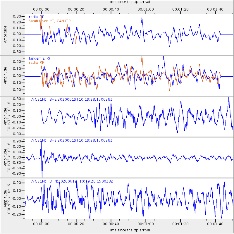
G31M Satah River, YT, CAN - Earthquake Result Viewer
*The percent match for this event was below the threshold and hence no stack was calculated.
| Earthquake location: |
Fiji Islands Region |
| Earthquake latitude/longitude: |
-17.5/-178.9 |
| Earthquake time(UTC): |
2020/06/19 (171) 10:07:55 GMT |
| Earthquake Depth: |
535 km |
| Earthquake Magnitude: |
5.6 Mww |
| Earthquake Catalog/Contributor: |
NEIC PDE/us |
|
| Network: |
TA USArray Transportable Network (new EarthScope stations) |
| Station: |
G31M Satah River, YT, CAN |
| Lat/Lon: |
66.92 N/134.27 W |
| Elevation: |
61 m |
|
| Distance: |
90.4 deg |
| Az: |
16.083 deg |
| Baz: |
222.127 deg |
| Ray Param: |
$rayparam |
*The percent match for this event was below the threshold and hence was not used in the summary stack. |
|
| Radial Match: |
54.099216 % |
| Radial Bump: |
400 |
| Transverse Match: |
51.054306 % |
| Transverse Bump: |
400 |
| SOD ConfigId: |
21709731 |
| Insert Time: |
2020-07-03 10:28:05.608 +0000 |
| GWidth: |
2.5 |
| Max Bumps: |
400 |
| Tol: |
0.001 |
|
Signal To Noise
| Channel | StoN | STA | LTA |
| TA:G31M: :BHZ:20200619T10:19:28.150028Z | 4.5816603 | 3.9416767E-7 | 8.603162E-8 |
| TA:G31M: :BHN:20200619T10:19:28.150028Z | 1.4258215 | 1.0358776E-7 | 7.265128E-8 |
| TA:G31M: :BHE:20200619T10:19:28.150028Z | 1.6465577 | 1.0600134E-7 | 6.4377545E-8 |
| Arrivals |
| Ps | |
| PpPs | |
| PsPs/PpSs | |


