You are here: Home > Network List > IU - Global Seismograph Network (GSN - IRIS/USGS) Stations List
> Station XMAS Kiritimati Island, Republic of Kiribati > Earthquake Result Viewer
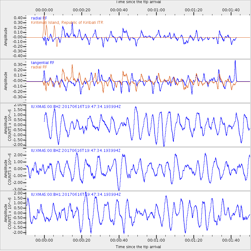
XMAS Kiritimati Island, Republic of Kiribati - Earthquake Result Viewer
*The percent match for this event was below the threshold and hence no stack was calculated.
| Earthquake location: |
Pacific-Antarctic Ridge |
| Earthquake latitude/longitude: |
-62.8/-161.1 |
| Earthquake time(UTC): |
2017/06/16 (167) 19:37:26 GMT |
| Earthquake Depth: |
10 km |
| Earthquake Magnitude: |
5.7 Mww |
| Earthquake Catalog/Contributor: |
NEIC PDE/us |
|
| Network: |
IU Global Seismograph Network (GSN - IRIS/USGS) |
| Station: |
XMAS Kiritimati Island, Republic of Kiribati |
| Lat/Lon: |
2.04 N/157.45 W |
| Elevation: |
20 m |
|
| Distance: |
64.8 deg |
| Az: |
4.005 deg |
| Baz: |
181.839 deg |
| Ray Param: |
$rayparam |
*The percent match for this event was below the threshold and hence was not used in the summary stack. |
|
| Radial Match: |
48.3281 % |
| Radial Bump: |
400 |
| Transverse Match: |
58.56106 % |
| Transverse Bump: |
400 |
| SOD ConfigId: |
2140511 |
| Insert Time: |
2017-06-30 11:32:25.946 +0000 |
| GWidth: |
2.5 |
| Max Bumps: |
400 |
| Tol: |
0.001 |
|
Signal To Noise
| Channel | StoN | STA | LTA |
| IU:XMAS:00:BHZ:20170616T19:47:34.193994Z | 0.5476751 | 5.327072E-7 | 9.726701E-7 |
| IU:XMAS:00:BH1:20170616T19:47:34.193994Z | 0.81934744 | 5.5297784E-7 | 6.749003E-7 |
| IU:XMAS:00:BH2:20170616T19:47:34.193994Z | 0.6692252 | 5.198496E-7 | 7.767932E-7 |
| Arrivals |
| Ps | |
| PpPs | |
| PsPs/PpSs | |


