You are here: Home > Network List > UW - Pacific Northwest Regional Seismic Network Stations List
> Station LEBA Lebam, WA, USA > Earthquake Result Viewer
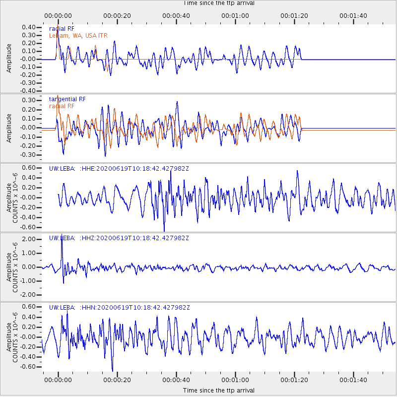
LEBA Lebam, WA, USA - Earthquake Result Viewer
*The percent match for this event was below the threshold and hence no stack was calculated.
| Earthquake location: |
Fiji Islands Region |
| Earthquake latitude/longitude: |
-17.5/-178.9 |
| Earthquake time(UTC): |
2020/06/19 (171) 10:07:55 GMT |
| Earthquake Depth: |
535 km |
| Earthquake Magnitude: |
5.6 Mww |
| Earthquake Catalog/Contributor: |
NEIC PDE/us |
|
| Network: |
UW Pacific Northwest Regional Seismic Network |
| Station: |
LEBA Lebam, WA, USA |
| Lat/Lon: |
46.55 N/123.56 W |
| Elevation: |
73 m |
|
| Distance: |
80.9 deg |
| Az: |
35.108 deg |
| Baz: |
232.689 deg |
| Ray Param: |
$rayparam |
*The percent match for this event was below the threshold and hence was not used in the summary stack. |
|
| Radial Match: |
54.80468 % |
| Radial Bump: |
400 |
| Transverse Match: |
53.96874 % |
| Transverse Bump: |
400 |
| SOD ConfigId: |
21709731 |
| Insert Time: |
2020-07-03 10:33:35.280 +0000 |
| GWidth: |
2.5 |
| Max Bumps: |
400 |
| Tol: |
0.001 |
|
Signal To Noise
| Channel | StoN | STA | LTA |
| UW:LEBA: :HHZ:20200619T10:18:42.427982Z | 5.7104535 | 6.3069774E-7 | 1.1044617E-7 |
| UW:LEBA: :HHN:20200619T10:18:42.427982Z | 2.2965686 | 2.4978513E-7 | 1.08764496E-7 |
| UW:LEBA: :HHE:20200619T10:18:42.427982Z | 1.8411624 | 2.3899625E-7 | 1.2980726E-7 |
| Arrivals |
| Ps | |
| PpPs | |
| PsPs/PpSs | |


