ULHL KN.ULHL - Earthquake Result Viewer
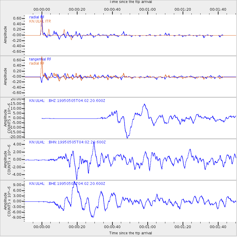
Earthquake location: Samar, Philippines
Earthquake latitude/longitude: 12.6/125.3
Earthquake time(UTC): 1995/05/05 (125) 03:53:47 GMT
Earthquake Depth: 33 km
Earthquake Magnitude: 6.2 MB, 7.0 MS, 7.1 UNKNOWN, 7.0 MW
Earthquake Catalog/Contributor: WHDF/NEIC
Network: KN Kyrgyz Seismic Telemetry Network
Station: ULHL KN.ULHL
Lat/Lon: 42.25 N/76.24 E
Elevation: 2040 m
Distance: 51.7 deg
Az: 314.341 deg
Baz: 109.91 deg
Ray Param: 0.067202054
Estimated Moho Depth: 43.5 km
Estimated Crust Vp/Vs: 1.99
Assumed Crust Vp: 6.306 km/s
Estimated Crust Vs: 3.165 km/s
Estimated Crust Poisson's Ratio: 0.33
Radial Match: 97.549515 %
Radial Bump: 261
Transverse Match: 84.845375 %
Transverse Bump: 400
SOD ConfigId: 6273
Insert Time: 2010-03-08 21:44:28.391 +0000
GWidth: 2.5
Max Bumps: 400
Tol: 0.001

Signal To Noise

ChannelStoNSTALTA
KN:ULHL: :BHN:19950505T04:02:20.600Z1.9977444.0743924E-82.0394967E-8
KN:ULHL: :BHE:19950505T04:02:20.600Z6.34148932.1641921E-73.4127506E-8
KN:ULHL: :BHZ:19950505T04:02:20.600Z5.66498043.5841916E-76.326926E-8
Arrivals
Ps7.2 SECOND
PpPs20 SECOND
PsPs/PpSs27 SECOND