ULHL KN.ULHL - Earthquake Result Viewer
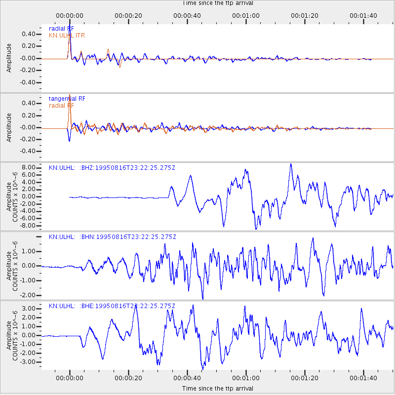
Earthquake location: Solomon Islands
Earthquake latitude/longitude: -5.8/154.3
Earthquake time(UTC): 1995/08/16 (228) 23:10:28 GMT
Earthquake Depth: 74 km
Earthquake Magnitude: 6.1 MB, 7.2 MS, 7.2 UNKNOWN, 7.2 MW
Earthquake Catalog/Contributor: WHDF/NEIC
Network: KN Kyrgyz Seismic Telemetry Network
Station: ULHL KN.ULHL
Lat/Lon: 42.25 N/76.24 E
Elevation: 2040 m
Distance: 85.0 deg
Az: 313.193 deg
Baz: 102.328 deg
Ray Param: 0.04490049
Estimated Moho Depth: 60.0 km
Estimated Crust Vp/Vs: 1.75
Assumed Crust Vp: 6.306 km/s
Estimated Crust Vs: 3.593 km/s
Estimated Crust Poisson's Ratio: 0.26
Radial Match: 97.33999 %
Radial Bump: 396
Transverse Match: 88.69933 %
Transverse Bump: 400
SOD ConfigId: 6273
Insert Time: 2010-03-08 21:44:39.882 +0000
GWidth: 2.5
Max Bumps: 400
Tol: 0.001

Signal To Noise

ChannelStoNSTALTA
KN:ULHL: :BHN:19950816T23:22:25.275Z2.77665859.188395E-83.3091556E-8
KN:ULHL: :BHE:19950816T23:22:25.275Z11.8004774.2650325E-73.614288E-8
KN:ULHL: :BHZ:19950816T23:22:25.275Z12.6344111.0047767E-67.9526984E-8
Arrivals
Ps7.4 SECOND
PpPs26 SECOND
PsPs/PpSs33 SECOND