ULHL KN.ULHL - Earthquake Result Viewer
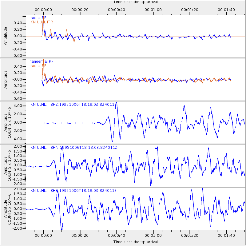
Earthquake location: Southern Sumatra, Indonesia
Earthquake latitude/longitude: -2.1/101.4
Earthquake time(UTC): 1995/10/06 (279) 18:09:45 GMT
Earthquake Depth: 33 km
Earthquake Magnitude: 5.8 MB, 6.9 MS, 6.8 UNKNOWN, 6.8 MW
Earthquake Catalog/Contributor: WHDF/NEIC
Network: KN Kyrgyz Seismic Telemetry Network
Station: ULHL KN.ULHL
Lat/Lon: 42.25 N/76.24 E
Elevation: 2040 m
Distance: 49.7 deg
Az: 335.522 deg
Baz: 146.106 deg
Ray Param: 0.068496205
Estimated Moho Depth: 10.25 km
Estimated Crust Vp/Vs: 1.61
Assumed Crust Vp: 6.306 km/s
Estimated Crust Vs: 3.923 km/s
Estimated Crust Poisson's Ratio: 0.18
Radial Match: 94.50233 %
Radial Bump: 400
Transverse Match: 85.22892 %
Transverse Bump: 400
SOD ConfigId: 6273
Insert Time: 2010-03-08 21:44:46.909 +0000
GWidth: 2.5
Max Bumps: 400
Tol: 0.001

Signal To Noise

ChannelStoNSTALTA
KN:ULHL: :BHN:19951006T18:18:03.824011Z1.92607081.00055416E-75.1947943E-8
KN:ULHL: :BHE:19951006T18:18:03.824011Z2.15474031.3309264E-76.1767366E-8
KN:ULHL: :BHZ:19951006T18:18:03.824011Z6.9588153.2677977E-74.695911E-8
Arrivals
Ps1.1 SECOND
PpPs4.0 SECOND
PsPs/PpSs5.0 SECOND