
ULHL KN.ULHL - Earthquake Result Viewer
| ||||||||||||||||||
| ||||||||||||||||||
| ||||||||||||||||||
|
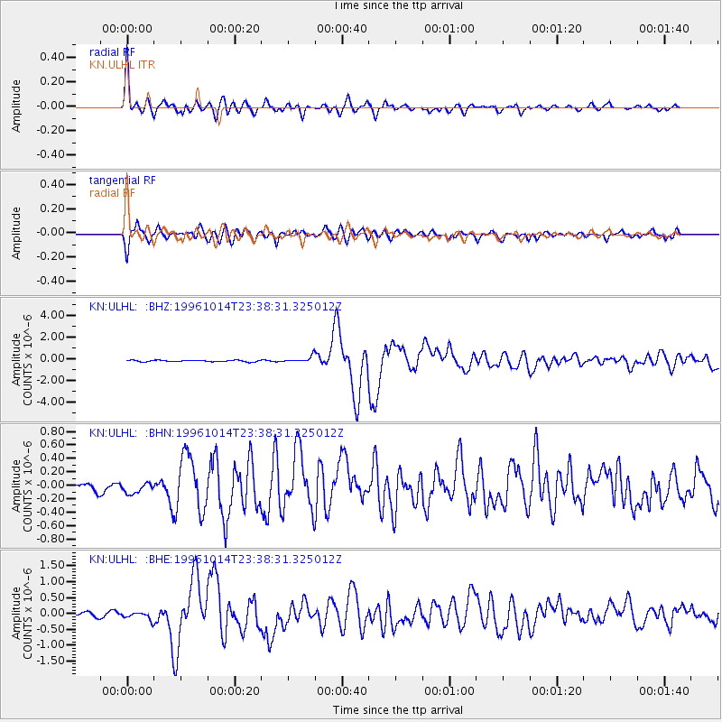
Signal To Noise
| Channel | StoN | STA | LTA |
| KN:ULHL: :BHN:19961014T23:38:31.325012Z | 1.3392291 | 8.4302414E-8 | 6.2948466E-8 |
| KN:ULHL: :BHE:19961014T23:38:31.325012Z | 1.7716388 | 1.2851119E-7 | 7.253803E-8 |
| KN:ULHL: :BHZ:19961014T23:38:31.325012Z | 4.4632745 | 2.9975496E-7 | 6.716032E-8 |
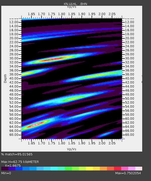
| Arrivals | |
| Ps | 6.8 SECOND |
| PpPs | 26 SECOND |
| PsPs/PpSs | 33 SECOND |

