ULHL KN.ULHL - Earthquake Result Viewer
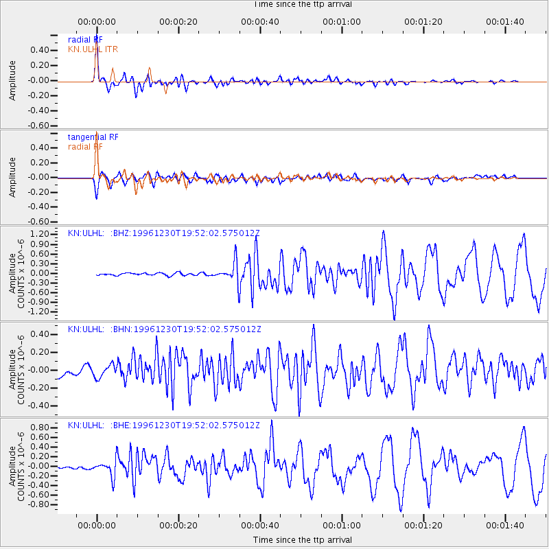
Earthquake location: Seram, Indonesia
Earthquake latitude/longitude: -4.0/128.1
Earthquake time(UTC): 1996/12/30 (365) 19:41:52 GMT
Earthquake Depth: 33 km
Earthquake Magnitude: 6.0 MB, 5.9 MS, 6.2 UNKNOWN, 6.0 MW
Earthquake Catalog/Contributor: WHDF/NEIC
Network: KN Kyrgyz Seismic Telemetry Network
Station: ULHL KN.ULHL
Lat/Lon: 42.25 N/76.24 E
Elevation: 2040 m
Distance: 65.7 deg
Az: 320.159 deg
Baz: 120.599 deg
Ray Param: 0.05802992
Estimated Moho Depth: 43.0 km
Estimated Crust Vp/Vs: 1.98
Assumed Crust Vp: 6.306 km/s
Estimated Crust Vs: 3.193 km/s
Estimated Crust Poisson's Ratio: 0.33
Radial Match: 94.60883 %
Radial Bump: 391
Transverse Match: 82.159996 %
Transverse Bump: 400
SOD ConfigId: 6273
Insert Time: 2010-03-08 21:45:43.232 +0000
GWidth: 2.5
Max Bumps: 400
Tol: 0.001

Signal To Noise

ChannelStoNSTALTA
KN:ULHL: :BHN:19961230T19:52:02.575012Z1.39498857.243098E-85.1922274E-8
KN:ULHL: :BHE:19961230T19:52:02.575012Z3.9678341.6587283E-74.1804377E-8
KN:ULHL: :BHZ:19961230T19:52:02.575012Z8.6266243.2484397E-73.7655976E-8
Arrivals
Ps6.9 SECOND
PpPs20 SECOND
PsPs/PpSs26 SECOND