You are here: Home > Network List > US - United States National Seismic Network Stations List
> Station DGMT Dagmar, Montana, USA > Earthquake Result Viewer
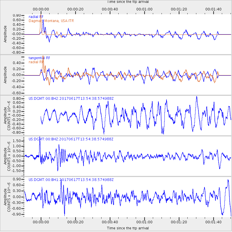
DGMT Dagmar, Montana, USA - Earthquake Result Viewer
*The percent match for this event was below the threshold and hence no stack was calculated.
| Earthquake location: |
Near Coast Of Nicaragua |
| Earthquake latitude/longitude: |
11.3/-86.7 |
| Earthquake time(UTC): |
2017/06/17 (168) 13:47:38 GMT |
| Earthquake Depth: |
28 km |
| Earthquake Magnitude: |
5.4 Mww |
| Earthquake Catalog/Contributor: |
NEIC PDE/us |
|
| Network: |
US United States National Seismic Network |
| Station: |
DGMT Dagmar, Montana, USA |
| Lat/Lon: |
48.47 N/104.20 W |
| Elevation: |
0.0 m |
|
| Distance: |
39.9 deg |
| Az: |
341.809 deg |
| Baz: |
152.603 deg |
| Ray Param: |
$rayparam |
*The percent match for this event was below the threshold and hence was not used in the summary stack. |
|
| Radial Match: |
59.506996 % |
| Radial Bump: |
400 |
| Transverse Match: |
50.99629 % |
| Transverse Bump: |
347 |
| SOD ConfigId: |
2140511 |
| Insert Time: |
2017-07-01 05:41:29.873 +0000 |
| GWidth: |
2.5 |
| Max Bumps: |
400 |
| Tol: |
0.001 |
|
Signal To Noise
| Channel | StoN | STA | LTA |
| US:DGMT:00:BHZ:20170617T13:54:38.574988Z | 5.9170537 | 5.6521014E-7 | 9.5522225E-8 |
| US:DGMT:00:BH1:20170617T13:54:38.574988Z | 1.2863728 | 2.6098064E-7 | 2.0288104E-7 |
| US:DGMT:00:BH2:20170617T13:54:38.574988Z | 1.8451571 | 3.539674E-7 | 1.9183592E-7 |
| Arrivals |
| Ps | |
| PpPs | |
| PsPs/PpSs | |


