ULHL KN.ULHL - Earthquake Result Viewer
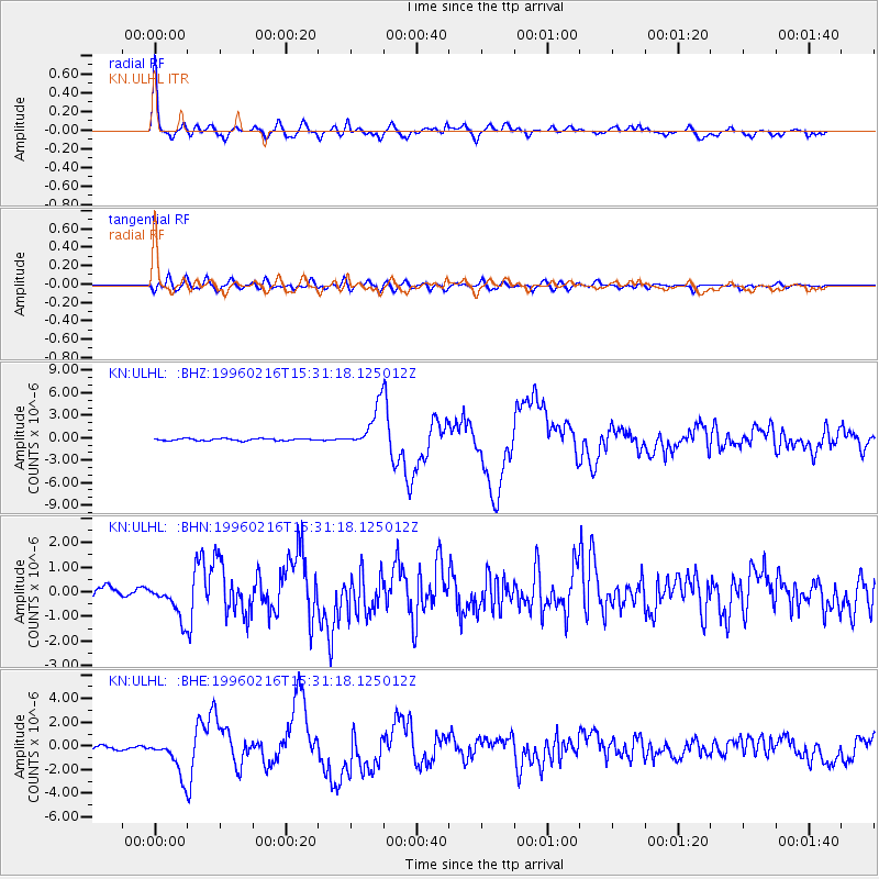
Earthquake location: Off East Coast Of Honshu, Japan
Earthquake latitude/longitude: 37.3/142.5
Earthquake time(UTC): 1996/02/16 (047) 15:22:57 GMT
Earthquake Depth: 33 km
Earthquake Magnitude: 6.2 MB, 6.2 MS, 6.7 UNKNOWN, 6.6 MW
Earthquake Catalog/Contributor: WHDF/NEIC
Network: KN Kyrgyz Seismic Telemetry Network
Station: ULHL KN.ULHL
Lat/Lon: 42.25 N/76.24 E
Elevation: 2040 m
Distance: 50.0 deg
Az: 297.456 deg
Baz: 72.26 deg
Ray Param: 0.06829524
Estimated Moho Depth: 44.0 km
Estimated Crust Vp/Vs: 1.87
Assumed Crust Vp: 6.306 km/s
Estimated Crust Vs: 3.377 km/s
Estimated Crust Poisson's Ratio: 0.30
Radial Match: 94.842804 %
Radial Bump: 400
Transverse Match: 77.7991 %
Transverse Bump: 400
SOD ConfigId: 6273
Insert Time: 2010-03-08 21:45:51.487 +0000
GWidth: 2.5
Max Bumps: 400
Tol: 0.001

Signal To Noise

ChannelStoNSTALTA
KN:ULHL: :BHN:19960216T15:31:18.125012Z5.6897347.299076E-71.2828501E-7
KN:ULHL: :BHE:19960216T15:31:18.125012Z11.9714841.5599096E-61.303021E-7
KN:ULHL: :BHZ:19960216T15:31:18.125012Z20.3549352.8115476E-61.381261E-7
Arrivals
Ps6.4 SECOND
PpPs19 SECOND
PsPs/PpSs25 SECOND