You are here: Home > Network List > US - United States National Seismic Network Stations List
> Station EGMT Eagleton, Montana, USA > Earthquake Result Viewer
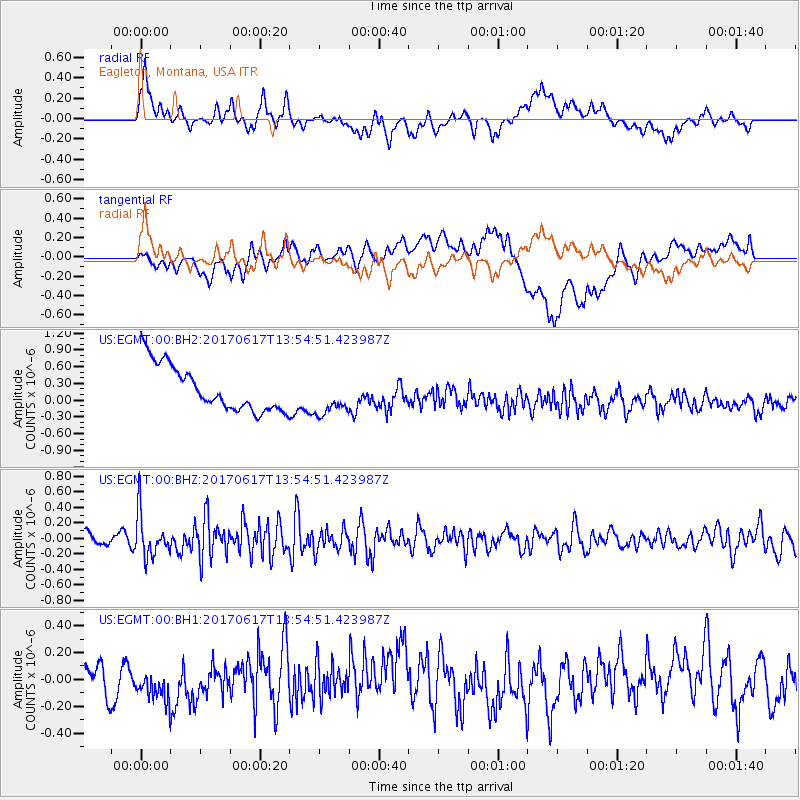
EGMT Eagleton, Montana, USA - Earthquake Result Viewer
*The percent match for this event was below the threshold and hence no stack was calculated.
| Earthquake location: |
Near Coast Of Nicaragua |
| Earthquake latitude/longitude: |
11.3/-86.7 |
| Earthquake time(UTC): |
2017/06/17 (168) 13:47:38 GMT |
| Earthquake Depth: |
28 km |
| Earthquake Magnitude: |
5.4 Mww |
| Earthquake Catalog/Contributor: |
NEIC PDE/us |
|
| Network: |
US United States National Seismic Network |
| Station: |
EGMT Eagleton, Montana, USA |
| Lat/Lon: |
48.02 N/109.75 W |
| Elevation: |
1055 m |
|
| Distance: |
41.4 deg |
| Az: |
336.584 deg |
| Baz: |
144.5 deg |
| Ray Param: |
$rayparam |
*The percent match for this event was below the threshold and hence was not used in the summary stack. |
|
| Radial Match: |
47.611446 % |
| Radial Bump: |
400 |
| Transverse Match: |
35.499046 % |
| Transverse Bump: |
400 |
| SOD ConfigId: |
2140511 |
| Insert Time: |
2017-07-01 05:41:35.668 +0000 |
| GWidth: |
2.5 |
| Max Bumps: |
400 |
| Tol: |
0.001 |
|
Signal To Noise
| Channel | StoN | STA | LTA |
| US:EGMT:00:BHZ:20170617T13:54:51.423987Z | 4.5795484 | 2.7529057E-7 | 6.0113045E-8 |
| US:EGMT:00:BH1:20170617T13:54:51.423987Z | 1.2499648 | 1.5213318E-7 | 1.2170997E-7 |
| US:EGMT:00:BH2:20170617T13:54:51.423987Z | 0.88692105 | 3.6127983E-7 | 4.073416E-7 |
| Arrivals |
| Ps | |
| PpPs | |
| PsPs/PpSs | |


