ULHL KN.ULHL - Earthquake Result Viewer
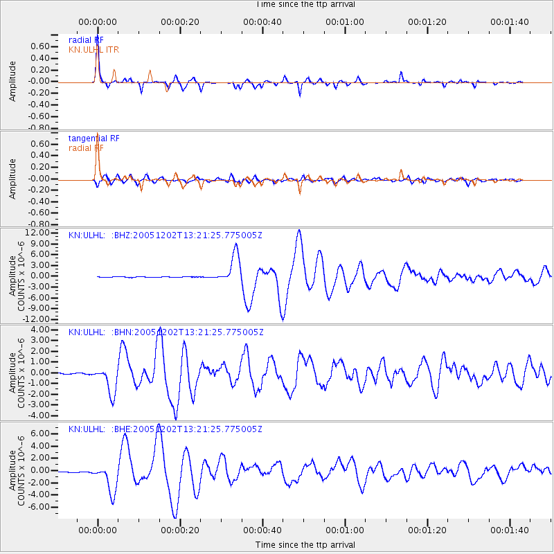
Earthquake location: Near East Coast Of Honshu, Japan
Earthquake latitude/longitude: 38.1/142.1
Earthquake time(UTC): 2005/12/02 (336) 13:13:09 GMT
Earthquake Depth: 29 km
Earthquake Magnitude: 6.1 MB, 6.3 MS, 6.5 MW, 6.4 MW
Earthquake Catalog/Contributor: WHDF/NEIC
Network: KN Kyrgyz Seismic Telemetry Network
Station: ULHL KN.ULHL
Lat/Lon: 42.25 N/76.24 E
Elevation: 2040 m
Distance: 49.4 deg
Az: 296.788 deg
Baz: 71.558 deg
Ray Param: 0.06868013
Estimated Moho Depth: 44.0 km
Estimated Crust Vp/Vs: 1.86
Assumed Crust Vp: 6.306 km/s
Estimated Crust Vs: 3.39 km/s
Estimated Crust Poisson's Ratio: 0.30
Radial Match: 96.01655 %
Radial Bump: 260
Transverse Match: 89.393234 %
Transverse Bump: 400
SOD ConfigId: 2422
Insert Time: 2010-03-08 21:46:47.907 +0000
GWidth: 2.5
Max Bumps: 400
Tol: 0.001

Signal To Noise

ChannelStoNSTALTA
KN:ULHL: :BHN:20051202T13:21:25.775005Z21.2059331.3330327E-66.286131E-8
KN:ULHL: :BHE:20051202T13:21:25.775005Z24.0210172.4504825E-61.020141E-7
KN:ULHL: :BHZ:20051202T13:21:25.775005Z52.6865164.295618E-68.1531645E-8
Arrivals
Ps6.3 SECOND
PpPs19 SECOND
PsPs/PpSs25 SECOND