You are here: Home > Network List > US - United States National Seismic Network Stations List
> Station HAWA Hanford, Washington, USA > Earthquake Result Viewer
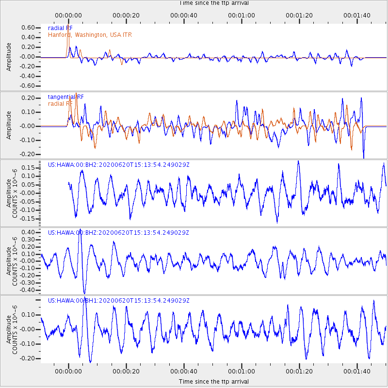
HAWA Hanford, Washington, USA - Earthquake Result Viewer
*The percent match for this event was below the threshold and hence no stack was calculated.
| Earthquake location: |
Iceland Region |
| Earthquake latitude/longitude: |
66.5/-18.4 |
| Earthquake time(UTC): |
2020/06/20 (172) 15:05:11 GMT |
| Earthquake Depth: |
10 km |
| Earthquake Magnitude: |
5.4 Mww |
| Earthquake Catalog/Contributor: |
NEIC PDE/us |
|
| Network: |
US United States National Seismic Network |
| Station: |
HAWA Hanford, Washington, USA |
| Lat/Lon: |
46.39 N/119.53 W |
| Elevation: |
364 m |
|
| Distance: |
52.6 deg |
| Az: |
301.275 deg |
| Baz: |
29.721 deg |
| Ray Param: |
$rayparam |
*The percent match for this event was below the threshold and hence was not used in the summary stack. |
|
| Radial Match: |
47.329044 % |
| Radial Bump: |
400 |
| Transverse Match: |
49.651695 % |
| Transverse Bump: |
400 |
| SOD ConfigId: |
21709731 |
| Insert Time: |
2020-07-04 15:33:08.975 +0000 |
| GWidth: |
2.5 |
| Max Bumps: |
400 |
| Tol: |
0.001 |
|
Signal To Noise
| Channel | StoN | STA | LTA |
| US:HAWA:00:BHZ:20200620T15:13:54.249029Z | 2.7155025 | 2.1381143E-7 | 7.873734E-8 |
| US:HAWA:00:BH1:20200620T15:13:54.249029Z | 1.4266847 | 7.587996E-8 | 5.3186213E-8 |
| US:HAWA:00:BH2:20200620T15:13:54.249029Z | 0.4397536 | 3.0151817E-8 | 6.856525E-8 |
| Arrivals |
| Ps | |
| PpPs | |
| PsPs/PpSs | |


