You are here: Home > Network List > BK - Berkeley Digital Seismograph Network Stations List
> Station HUMO Hull Mountain, OR > Earthquake Result Viewer
HUMO Hull Mountain, OR - Earthquake Result Viewer
*The percent match for this event was below the threshold and hence no stack was calculated.
| Earthquake location: |
South Of Fiji Islands |
| Earthquake latitude/longitude: |
-24.1/179.6 |
| Earthquake time(UTC): |
2017/06/17 (168) 22:26:02 GMT |
| Earthquake Depth: |
518 km |
| Earthquake Magnitude: |
6.1 Mww |
| Earthquake Catalog/Contributor: |
NEIC PDE/us |
|
| Network: |
BK Berkeley Digital Seismograph Network |
| Station: |
HUMO Hull Mountain, OR |
| Lat/Lon: |
42.61 N/122.96 W |
| Elevation: |
555 m |
|
| Distance: |
84.9 deg |
| Az: |
38.668 deg |
| Baz: |
230.657 deg |
| Ray Param: |
$rayparam |
*The percent match for this event was below the threshold and hence was not used in the summary stack. |
|
| Radial Match: |
74.86483 % |
| Radial Bump: |
400 |
| Transverse Match: |
64.60538 % |
| Transverse Bump: |
400 |
| SOD ConfigId: |
2140511 |
| Insert Time: |
2017-07-01 14:19:04.886 +0000 |
| GWidth: |
2.5 |
| Max Bumps: |
400 |
| Tol: |
0.001 |
|
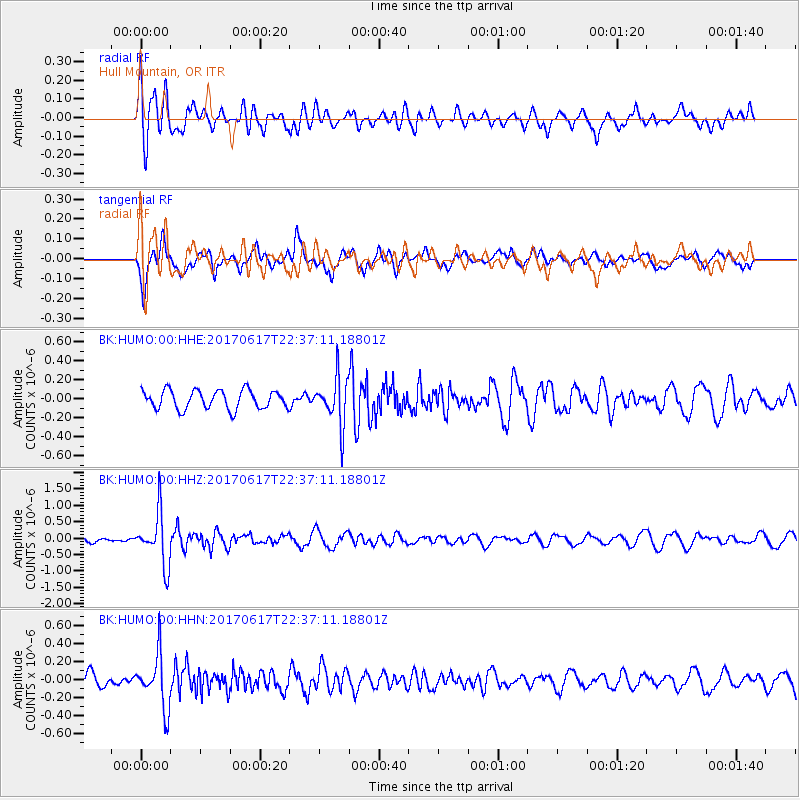
Signal To Noise
| Channel | StoN | STA | LTA |
| BK:HUMO:00:HHZ:20170617T22:37:11.18801Z | 5.86085 | 7.9175453E-7 | 1.3509211E-7 |
| BK:HUMO:00:HHN:20170617T22:37:11.18801Z | 3.5558949 | 2.9417035E-7 | 8.272752E-8 |
| BK:HUMO:00:HHE:20170617T22:37:11.18801Z | 2.542816 | 2.494253E-7 | 9.80902E-8 |
| Arrivals |
| Ps | |
| PpPs | |
| PsPs/PpSs | |


