You are here: Home > Network List > IU - Global Seismograph Network (GSN - IRIS/USGS) Stations List
> Station RSSD Black Hills, South Dakota, USA > Earthquake Result Viewer
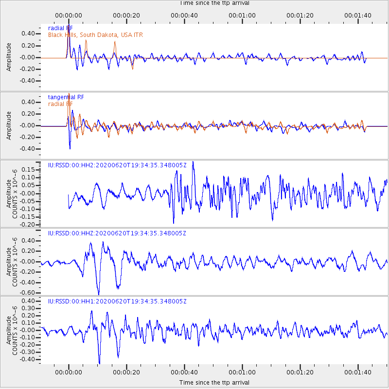
RSSD Black Hills, South Dakota, USA - Earthquake Result Viewer
*The percent match for this event was below the threshold and hence no stack was calculated.
| Earthquake location: |
Iceland Region |
| Earthquake latitude/longitude: |
66.3/-18.9 |
| Earthquake time(UTC): |
2020/06/20 (172) 19:26:21 GMT |
| Earthquake Depth: |
10 km |
| Earthquake Magnitude: |
5.7 mww |
| Earthquake Catalog/Contributor: |
NEIC PDE/us |
|
| Network: |
IU Global Seismograph Network (GSN - IRIS/USGS) |
| Station: |
RSSD Black Hills, South Dakota, USA |
| Lat/Lon: |
44.12 N/104.04 W |
| Elevation: |
2090 m |
|
| Distance: |
48.8 deg |
| Az: |
287.393 deg |
| Baz: |
32.403 deg |
| Ray Param: |
$rayparam |
*The percent match for this event was below the threshold and hence was not used in the summary stack. |
|
| Radial Match: |
77.519165 % |
| Radial Bump: |
400 |
| Transverse Match: |
72.475 % |
| Transverse Bump: |
400 |
| SOD ConfigId: |
21709731 |
| Insert Time: |
2020-07-04 19:36:26.151 +0000 |
| GWidth: |
2.5 |
| Max Bumps: |
400 |
| Tol: |
0.001 |
|
Signal To Noise
| Channel | StoN | STA | LTA |
| IU:RSSD:00:HHZ:20200620T19:34:35.348005Z | 2.3837655 | 8.9034366E-8 | 3.7350304E-8 |
| IU:RSSD:00:HH1:20200620T19:34:35.348005Z | 1.2725734 | 3.946183E-8 | 3.1009474E-8 |
| IU:RSSD:00:HH2:20200620T19:34:35.348005Z | 0.6501104 | 2.4665377E-8 | 3.794029E-8 |
| Arrivals |
| Ps | |
| PpPs | |
| PsPs/PpSs | |


