You are here: Home > Network List > IU - Global Seismograph Network (GSN - IRIS/USGS) Stations List
> Station JOHN Johnston Island, USA > Earthquake Result Viewer
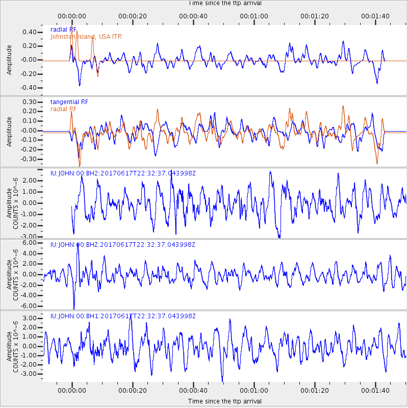
JOHN Johnston Island, USA - Earthquake Result Viewer
*The percent match for this event was below the threshold and hence no stack was calculated.
| Earthquake location: |
South Of Fiji Islands |
| Earthquake latitude/longitude: |
-24.1/179.6 |
| Earthquake time(UTC): |
2017/06/17 (168) 22:26:02 GMT |
| Earthquake Depth: |
518 km |
| Earthquake Magnitude: |
6.1 Mww |
| Earthquake Catalog/Contributor: |
NEIC PDE/us |
|
| Network: |
IU Global Seismograph Network (GSN - IRIS/USGS) |
| Station: |
JOHN Johnston Island, USA |
| Lat/Lon: |
16.73 N/169.53 W |
| Elevation: |
2.0 m |
|
| Distance: |
42.0 deg |
| Az: |
15.695 deg |
| Baz: |
194.951 deg |
| Ray Param: |
$rayparam |
*The percent match for this event was below the threshold and hence was not used in the summary stack. |
|
| Radial Match: |
54.439335 % |
| Radial Bump: |
400 |
| Transverse Match: |
50.307327 % |
| Transverse Bump: |
400 |
| SOD ConfigId: |
2140511 |
| Insert Time: |
2017-07-01 14:21:48.105 +0000 |
| GWidth: |
2.5 |
| Max Bumps: |
400 |
| Tol: |
0.001 |
|
Signal To Noise
| Channel | StoN | STA | LTA |
| IU:JOHN:00:BHZ:20170617T22:32:37.043998Z | 3.3960588 | 2.613629E-6 | 7.696065E-7 |
| IU:JOHN:00:BH1:20170617T22:32:37.043998Z | 0.88807684 | 9.247799E-7 | 1.0413287E-6 |
| IU:JOHN:00:BH2:20170617T22:32:37.043998Z | 1.3046713 | 1.3311125E-6 | 1.0202665E-6 |
| Arrivals |
| Ps | |
| PpPs | |
| PsPs/PpSs | |


