You are here: Home > Network List > UU - University of Utah Regional Network Stations List
> Station FORU South Mineral Mountains, UT, USA > Earthquake Result Viewer
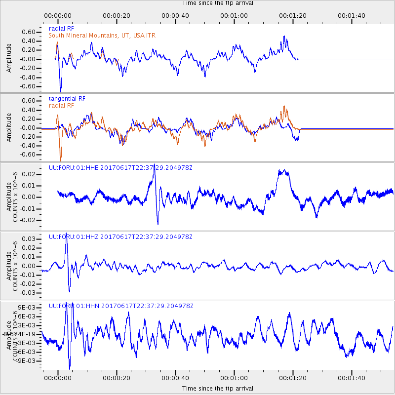
FORU South Mineral Mountains, UT, USA - Earthquake Result Viewer
*The percent match for this event was below the threshold and hence no stack was calculated.
| Earthquake location: |
South Of Fiji Islands |
| Earthquake latitude/longitude: |
-24.1/179.6 |
| Earthquake time(UTC): |
2017/06/17 (168) 22:26:02 GMT |
| Earthquake Depth: |
518 km |
| Earthquake Magnitude: |
6.1 Mww |
| Earthquake Catalog/Contributor: |
NEIC PDE/us |
|
| Network: |
UU University of Utah Regional Network |
| Station: |
FORU South Mineral Mountains, UT, USA |
| Lat/Lon: |
38.46 N/112.86 W |
| Elevation: |
1840 m |
|
| Distance: |
88.7 deg |
| Az: |
46.532 deg |
| Baz: |
237.646 deg |
| Ray Param: |
$rayparam |
*The percent match for this event was below the threshold and hence was not used in the summary stack. |
|
| Radial Match: |
55.47043 % |
| Radial Bump: |
309 |
| Transverse Match: |
72.94477 % |
| Transverse Bump: |
286 |
| SOD ConfigId: |
2140511 |
| Insert Time: |
2017-07-01 14:25:42.701 +0000 |
| GWidth: |
2.5 |
| Max Bumps: |
400 |
| Tol: |
0.001 |
|
Signal To Noise
| Channel | StoN | STA | LTA |
| UU:FORU:01:HHZ:20170617T22:37:29.204978Z | 6.531351 | 1.4149061E-8 | 2.1663298E-9 |
| UU:FORU:01:HHN:20170617T22:37:29.204978Z | 1.5671962 | 5.3252722E-9 | 3.3979612E-9 |
| UU:FORU:01:HHE:20170617T22:37:29.204978Z | 4.467761 | 1.3086342E-8 | 2.9290605E-9 |
| Arrivals |
| Ps | |
| PpPs | |
| PsPs/PpSs | |


