ULHL KN.ULHL - Earthquake Result Viewer
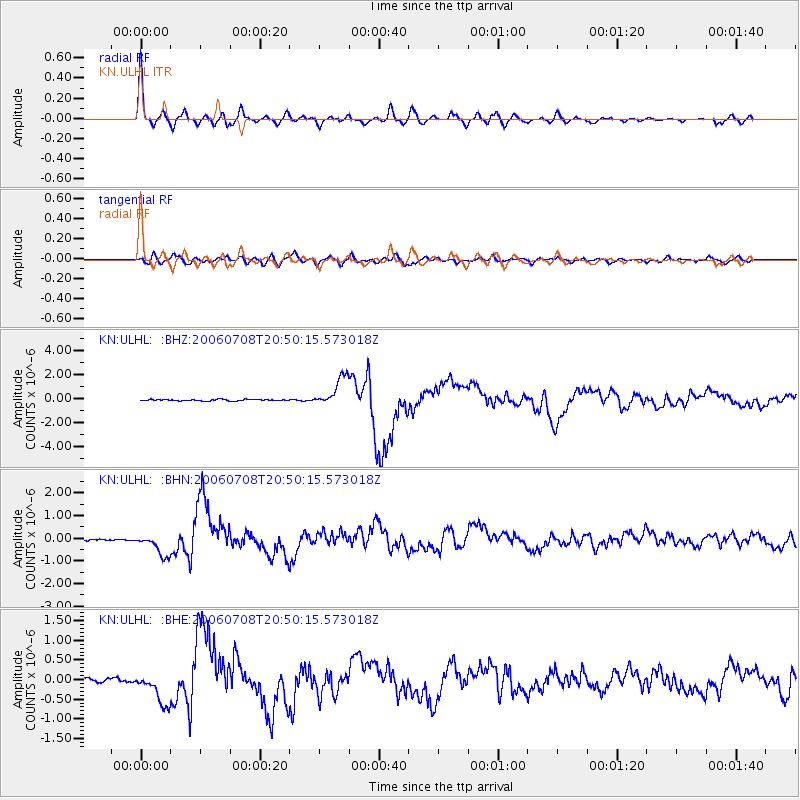
Earthquake location: Andreanof Islands, Aleutian Is.
Earthquake latitude/longitude: 51.2/-179.3
Earthquake time(UTC): 2006/07/08 (189) 20:40:00 GMT
Earthquake Depth: 22 km
Earthquake Magnitude: 6.2 MB, 6.4 MS, 6.6 MW, 6.6 MW
Earthquake Catalog/Contributor: WHDF/NEIC
Network: KN Kyrgyz Seismic Telemetry Network
Station: ULHL KN.ULHL
Lat/Lon: 42.25 N/76.24 E
Elevation: 2040 m
Distance: 66.2 deg
Az: 308.175 deg
Baz: 41.753 deg
Ray Param: 0.05777474
Estimated Moho Depth: 24.5 km
Estimated Crust Vp/Vs: 1.92
Assumed Crust Vp: 6.306 km/s
Estimated Crust Vs: 3.284 km/s
Estimated Crust Poisson's Ratio: 0.31
Radial Match: 96.29505 %
Radial Bump: 400
Transverse Match: 85.12782 %
Transverse Bump: 400
SOD ConfigId: 2665
Insert Time: 2010-03-08 21:53:45.317 +0000
GWidth: 2.5
Max Bumps: 400
Tol: 0.001

Signal To Noise

ChannelStoNSTALTA
KN:ULHL: :BHN:20060708T20:50:15.573018Z12.0609594.8488204E-74.020261E-8
KN:ULHL: :BHE:20060708T20:50:15.573018Z9.5623194.1067716E-74.294744E-8
KN:ULHL: :BHZ:20060708T20:50:15.573018Z19.2583921.232383E-66.3992E-8
Arrivals
Ps3.7 SECOND
PpPs11 SECOND
PsPs/PpSs15 SECOND