ULHL KN.ULHL - Earthquake Result Viewer
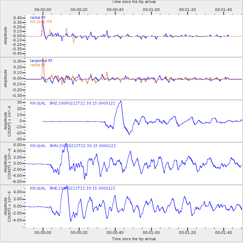
Earthquake location: Mozambique
Earthquake latitude/longitude: -21.3/33.6
Earthquake time(UTC): 2006/02/22 (053) 22:19:07 GMT
Earthquake Depth: 11 km
Earthquake Magnitude: 6.5 MB, 7.5 MS, 7.0 MW, 7.0 MW
Earthquake Catalog/Contributor: WHDF/NEIC
Network: KN Kyrgyz Seismic Telemetry Network
Station: ULHL KN.ULHL
Lat/Lon: 42.25 N/76.24 E
Elevation: 2040 m
Distance: 74.5 deg
Az: 31.473 deg
Baz: 220.964 deg
Ray Param: 0.052278385
Estimated Moho Depth: 39.25 km
Estimated Crust Vp/Vs: 1.77
Assumed Crust Vp: 6.306 km/s
Estimated Crust Vs: 3.558 km/s
Estimated Crust Poisson's Ratio: 0.27
Radial Match: 98.39724 %
Radial Bump: 391
Transverse Match: 91.57969 %
Transverse Bump: 400
SOD ConfigId: 2422
Insert Time: 2010-03-08 21:54:37.321 +0000
GWidth: 2.5
Max Bumps: 400
Tol: 0.001

Signal To Noise

ChannelStoNSTALTA
KN:ULHL: :BHN:20060222T22:30:15.000012Z5.37786252.5901585E-74.8163344E-8
KN:ULHL: :BHE:20060222T22:30:15.000012Z2.58864362.1555886E-78.327097E-8
KN:ULHL: :BHZ:20060222T22:30:15.000012Z25.9756051.302542E-65.014482E-8
Arrivals
Ps5.0 SECOND
PpPs17 SECOND
PsPs/PpSs22 SECOND